

Meteorologist Tony Nargi's First Warning Forecast
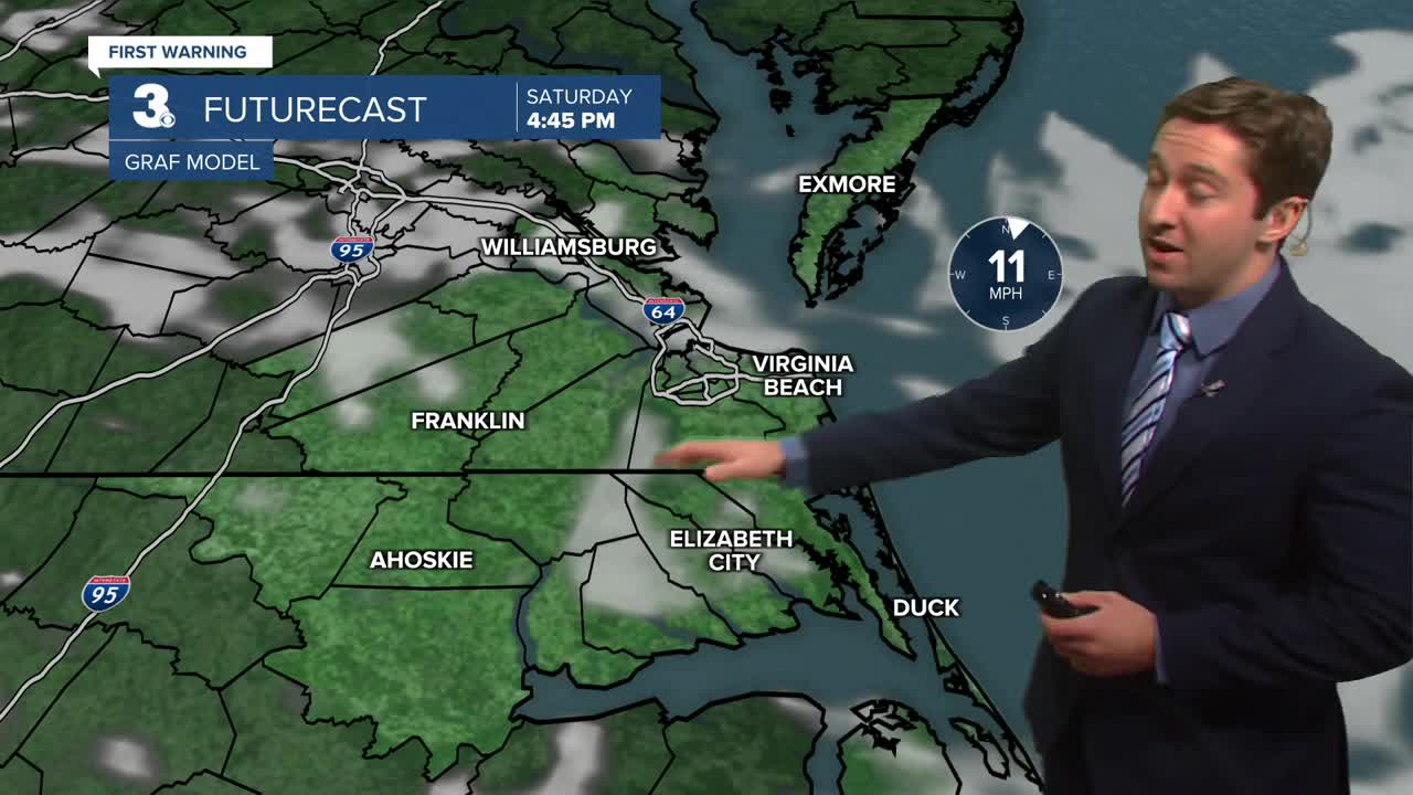
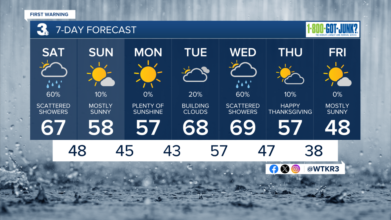
Today will start off with fog and showers possible throughout the morning. Showers are likely through midday, with clearing skies and drying out expected during the afternoon as showers move offshore. Highs will reach the upper 60s to near 70 around noon, with temperatures dropping into the lower 60s during the afternoon. Winds will be out of the SW at 5-10 mph in the morning, turning out of the NW at 10-15 mph during the afternoon. Overnight skies will slowly clear out, with lows in the 40s expected.

Tomorrow will be mostly sunny along with cooler conditions. Highs will be in the mid to upper 50s, with winds out of the NE at 5-15 mph. A stray sprinkle is possible in the morning, with dry conditions expected throughout the rest of the day. Tomorrow night will be clear and cool with temperatures dropping into the 30s to mid 40s. Monday will be sunny with high temperatures in the low to mid 50s. Winds will be light out of the N at 5-10 mph.


Next week temperatures will increase on Tuesday and Wednesday with increasing chances of rain as well. A cold front will move through on Wednesday night, bringing cooler conditions for Thanksgiving.
Weather updates on social media:
