


Meteorologist Maddie Kirker's First Warning Forecast:
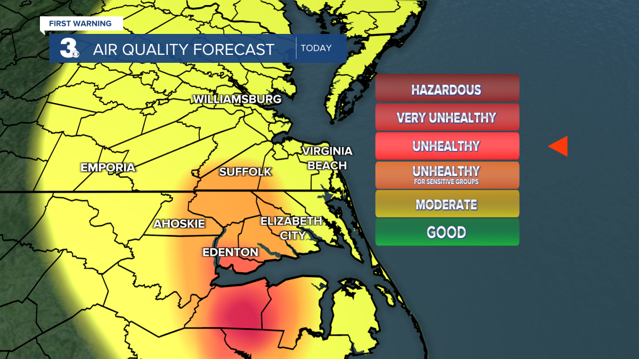
Smoky again today and even hotter, heat index near 100... Good morning! We're waking up to another smoky start thanks to the south winds and the Ferebee Wildfire that continues to burn in Hyde County, NC. This smoke will lead to unhealthy air quality today, especially across eastern North Carolina, however everyone will smell it again today.

Get ready for the hottest day of the week. As we kick off the first day of July, highs will soar to the low 90s but it will feel more like 100. Winds will be out of the south between 5 and 15 mph. A few storms will be possible this afternoon and evening, primarily inland.
Let's talk storm chances this weekend. Showers and storms will be possible Saturday but as it stands Sunday late-day features the highest storm chance over the holiday weekend. Heavy rain will be possible with any storms that develop. Highs Saturday will be hot in the 90s and warm Sunday in the upper 80s. Our 4th of July is looking drier, featuring only a slight chance of showers and storms with highs in the 80s.
