


Meteorologist Myles Henderson’s First Warning Forecast
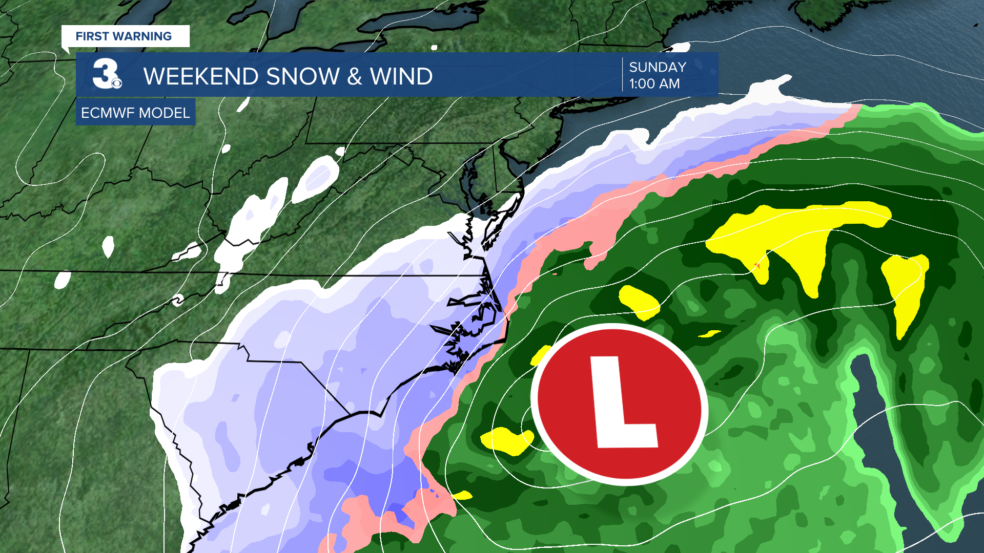
Snow, wind, and flooding this weekend as a coastal storm develops along the East Coast.
Snow will build in today from scattered showers this morning to widespread snow this afternoon. It will be cold today with highs in the mid 20s. The wind will also ramp up through the day with gusts to 30+ mph by the afternoon. Wind chill values will linger near 10 for most of the day.

Snow will move out Sunday morning, and clouds will start to clear out in the afternoon. It will still be very cold and windy tomorrow. The wind chill will be near 0 Sunday morning and in the teens Sunday afternoon.

Most of the area will see snow but some rain could mix in for the southern Outer Banks. Higher snow totals are likely to the south and east and lower totals to the north and west. 8” to 10” for the Albemarle and northern Outer Banks, 4” to 8” from the Southside to inland NC, 1” to 4” for the Peninsulas and Eastern Shore.

This system will also bring us very strong winds throughout the weekend. Wind will ramp up through Saturday and will be the strongest Sunday morning. Expect wind gusts to 40+ mph for many areas and 50+ along the coast. Wind will slowly back down Sunday PM to Monday.

We will also see tidal/coastal flooding. Watch out for flooding near times of high tide this weekend with the biggest flooding risk Sunday morning. We could also see areas of ocean overwash on the Outer Banks.

Today: Snow Building In, Windy. Highs in the mid 20s. Winds: NE/N 15-25 G35+
Tonight: Snow, Windy. Lows in the upper teens. Winds: N 25-35 G45+
Tomorrow: AM Snow, Windy. Highs in the upper 20s. Winds: N/NW 20-30 G40+
Weather updates on social media:
Facebook: MylesHendersonWTKR
Instagram: @MylesHendersonWTKR
