

Meteorologist Tony Nargi's First Warning Forecast
This evening temperatures will drop into the low 40s and 30s as clouds fill in. The first flakes will begin to fall for parts of our area between 12 am and 3 am. Winds will be out of the NE at 5-10 mph.


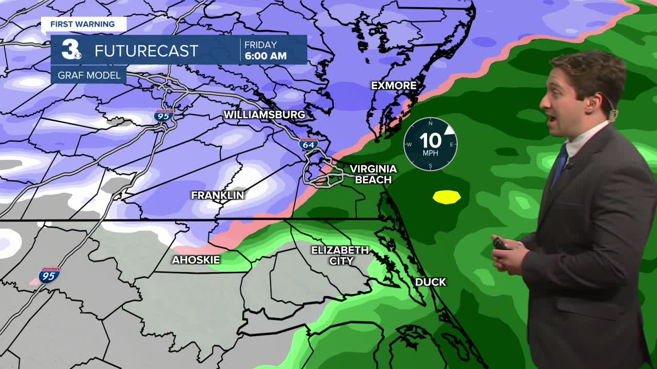
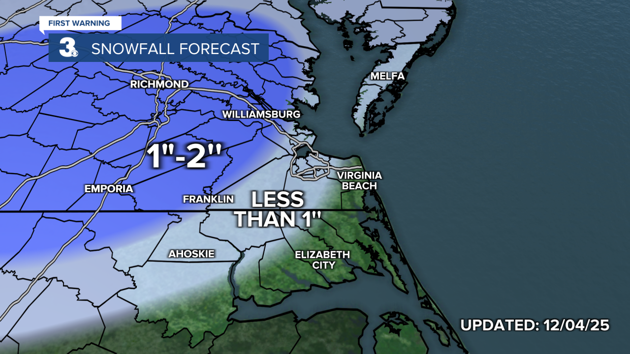
Tomorrow morning light to moderate snow will fall between 3 am and 9 am, with inland areas along with the Peninsulas (away from the immediate shoreline) seeing the worst conditions. A winter weather advisory is in place for the peninsulas, eastern shore, and interior counties west of Suffolk. Temperatures in the low to mid 30s will keep snow from accumulating rapidly on roadways, though some slick and slushy conditions will be possible for the morning commute! A T-2" of snow is expected for many in SE Virginia, with all rain expected in Virginia Beach and the Albemarle/Outer Banks in North Carolina. Snow will change over to rain everywhere by 9 am, with showers lingering into the afternoon. High temperatures will reach the low to mid 40s, with winds out of the NE at 5-10 mph. Showers should dry out Friday night as temperatures drop back into the 30s.

Saturday will be mostly cloudy and a bit warmer than Friday with highs in the mid to upper 40s. Winds will be out of the NW at 5-10 mph. A stray shower is possible, but most will stay dry all day. Overnight temps drop back into the 30s with some partial clearing expected. Sunday will be partly cloudy and dry, with highs in the upper 40s to low 50s.

Another chance of rain arrives on Monday as a cold front passes through Sunday night into Monday morning. Cool conditions are expected to continue to begin next week, with highs in the 40s to low 50s.

Weather updates on social media:
