

Derrah Getter's First Warning Forecast
Snow showers begin nudging in... slowly but surely.

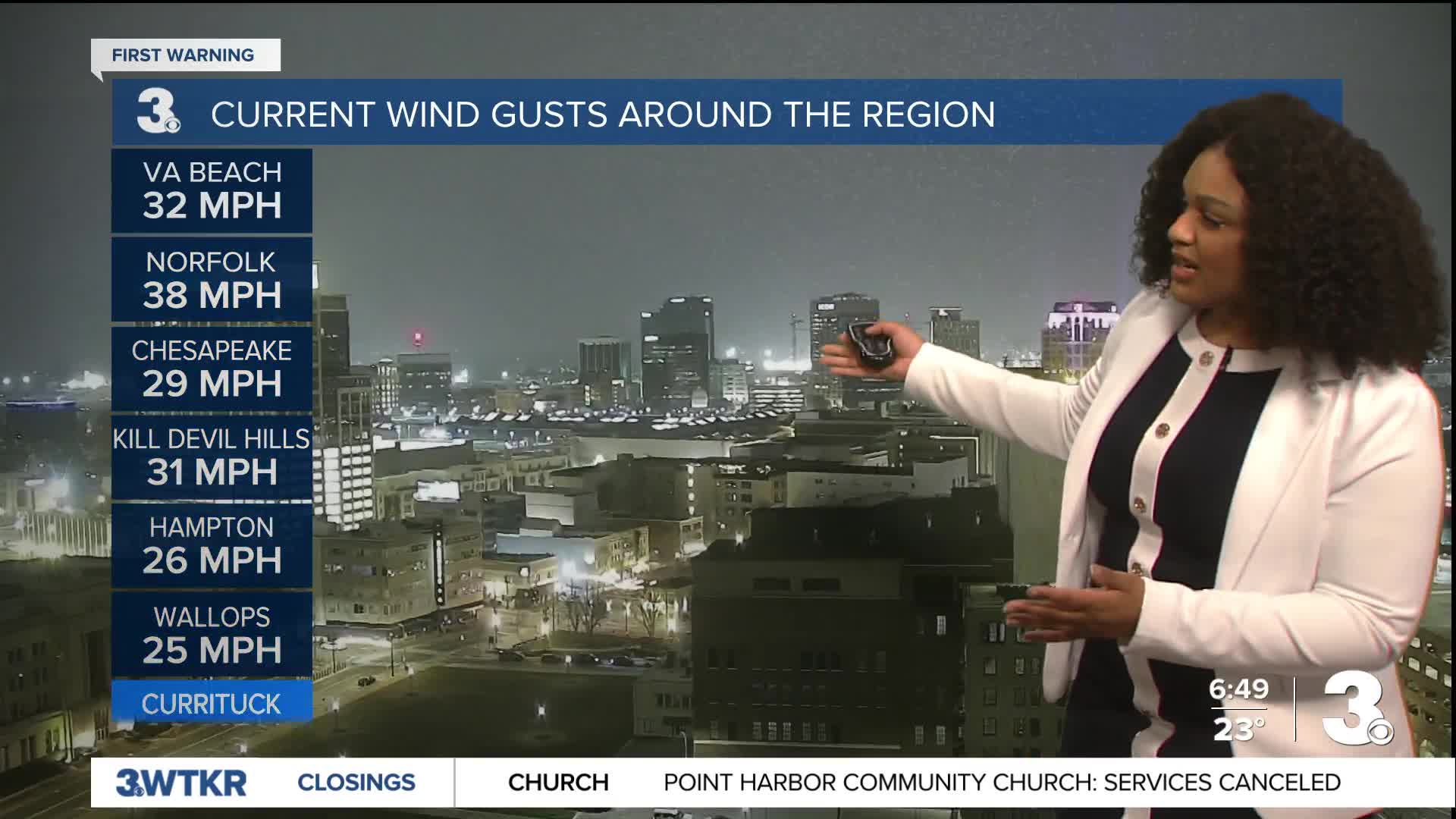
This evening, snow showers spread from southeast to northwest. Winds ramp up close to midnight with gusts 30-50 mph. A few areas could see isolated wind gusts up to 60 mph. The snow ends overnight, leaving behind cloudy conditions Sunday morning. Tidal flooding will be the “worst” Sunday morning between 7 and 9 am. Wind chill values will be brutally cold. It will feel as low as –5 degrees in the morning and it won't feel much better as the day goes on. Despite high temperatures in the low 20s, it will only feel like the single digits and teens Sunday afternoon.

The winds fade Sunday night, but gusts will still hang around 30 mph. With the below freezing temperatures, the tidal flooding will have time to freeze, and leftover snow will likely create some issues for Monday morning’s commute.
Temperatures finally come back up above freezing Monday afternoon. This will initiate the melt and refreeze process we’ll see throughout the week. There will be additional chances for rain and a few flakes around Wednesday.

Let's connect on social media!
Forecaster Derrah Getter:
For weather updates on Facebook: HERE
For weather updates on X: HERE
Follow me on Instagram: HERE
Check out the Interactive Radar on WTKR.com: Interactive Radar
