


Meteorologist Myles Henderson’s First Warning Forecast
***Winter Storm Warning for NE NC, most of the Southside, and parts of the Peninsula. Winter Storm Watch for parts of Central VA, the Middle Peninsula, and the Eastern Shore.

Snow, wind, and flooding this weekend as a coastal storm develops along the East Coast.
Another cold morning with temperatures near 20. Highs will struggle to reach 30 this afternoon. Look for building clouds, partly to mostly cloudy skies with a stray shower or flurries possible.

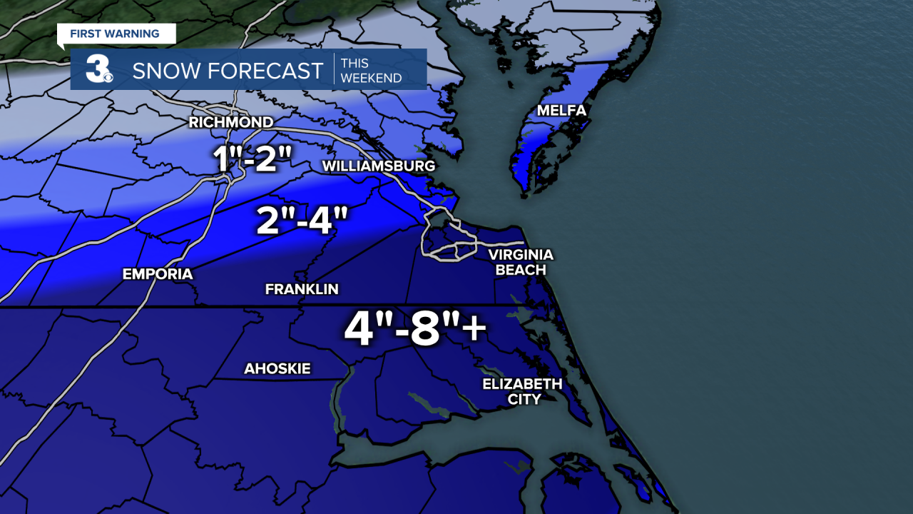
We are watching another chance for wintry weather this weekend as an area of low-pressure develops to our south and slides up the East Coast. The track of the low will determine how much snow we see (closer to the coast, more snow, away from the coast, less snow).

Snow will build in Saturday morning and pick up through the day. Snow will move out Sunday morning to midday. Most of the area will see snow but some rain could mix in for the southern Outer Banks. Higher snow totals are likely to the south and east (4” to 8”+) and lower totals to the north and west (1” to 4”).
This system will also bring us very strong winds. Wind will ramp up through Saturday and will be the strongest Sunday morning. Expect wind gusts to 40+ mph for many areas and 50+ along the coast.

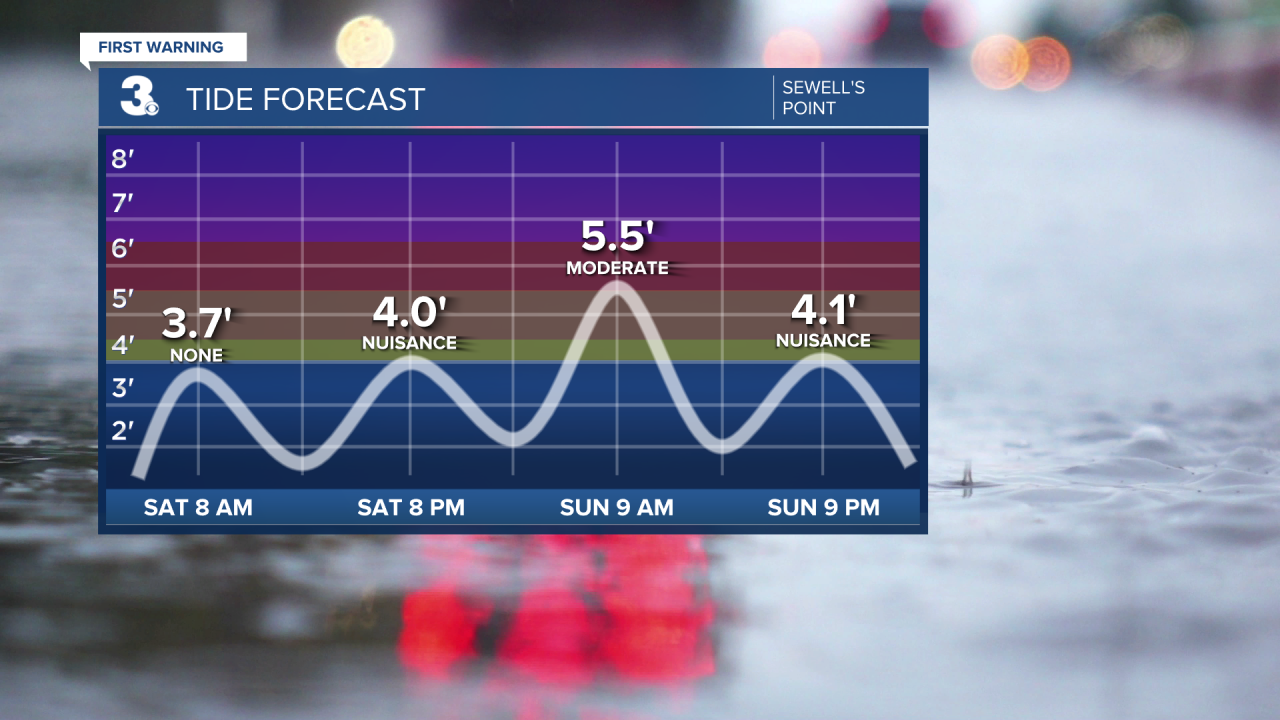
We will also see tidal/coastal flooding. Watch out for flooding near times of high tide this weekend with the biggest flooding risk Sunday morning. We could also see areas of ocean overwash on the Outer Banks.
Today: Building Clouds. Highs near 30. Winds: N 5-10
Tonight: Mostly Cloudy. Lows near 20. Winds: N 5-15
Tomorrow: Snow, Windy. Highs in the upper 20s. Winds: N 15-25 G35+
Weather updates on social media:
Facebook: MylesHendersonWTKR
Instagram: @MylesHendersonWTKR
