

Meteorologist Tony Nargi's First Warning Forecast
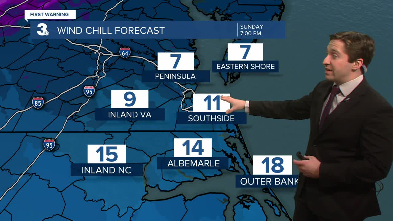
This morning temperatures will start in the upper 30s and lower 40s with some light rain possible before 7 am. After 7 am temperatures will begin dropping into the lower 30s, with rain turning over to snow. Expect snow to last through midday, with clearing expected during the afternoon. A trace to an inch of snow is expected for most of the region. Temperatures will drop into the upper 20s by the end of the day. Overnight a Cold Weather Advisory is in effect for wind chills dropping into the single digits. A Wind Advisory is also in effect along the shoreline for gusts up to 50 mph.


Tomorrow morning temperatures will start in the teens and low 20s, with high temperatures only reaching the low to mid 30s. Winds will be calmer, out of the NW at 5-15 mph. We'll see mostly sunny skies and dry conditions expected. Tuesday morning will start out cold again, with temperatures in the teens and 20s to start. We'll see mostly sunny skies once again on Tuesday. Temperatures will rebound a bit by Tuesday afternoon, with high temperatures in the mid 40s. Winds will be light out of the W at 5-10 mph.


Our cold air mass will leave us by Wednesday, with temperatures returning to near normal in the 50s. By Thursday we'll reach the 60s, before our next chance of rain arrives on Friday.

Weather updates on social media:
