


After an all-too brief break, the extreme heat and humidity returned on Sunday and it is going to stick around for a few days. As a matter of fact, much of the area is under a heat advisory on Monday.

We are expecting plenty of sunshine to start the work week with high temperatures in the upper 90s and lower triple digits. When you factor in the humidity it will feel like close to 110° on Monday afternoon. And the forecast is very similar on Tuesday.
When you get that much heat and humidity building up, thunderstorms are almost always possible. We don’t expect widespread storms on Monday or Tuesday, but a few isolated storms are certainly possible both days.

On Wednesday, a slow-moving cold front approaches our region bringing more clouds and scattered showers and thunderstorms. That will help cool things down into the upper 80s in the lower 90s.
As that front crosses the region, the forecast is much the same on Thursday and Friday.
That cold front will finally wash itself out by Saturday and then we return to a very familiar summer pattern, with a chance for afternoon thunderstorms under a mixture of clouds and sunshine.
We will also be keeping a very close eye on what is now a strong tropical wave in the Atlantic. It has a very good chance to develop into a tropical storm or even a hurricane over the next few days.

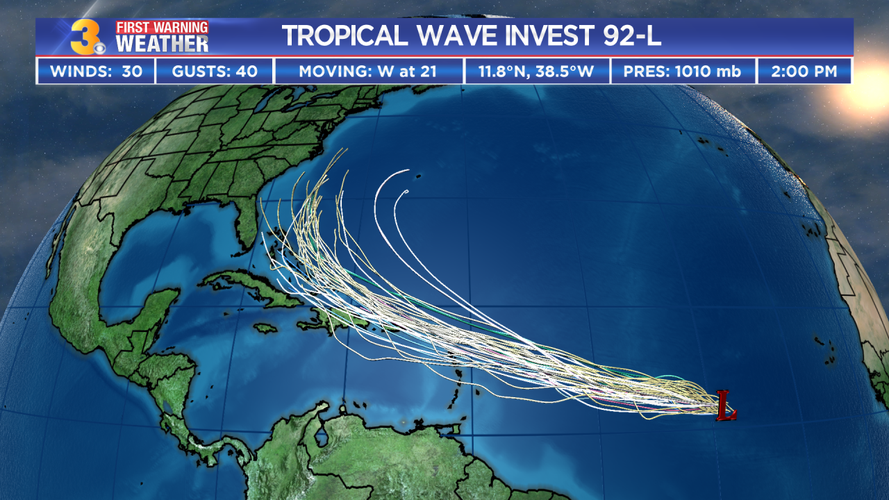
Many of the forecast models bring the storm toward the East Coast as we head toward next weekend. We will be tracking it closely.
