First Warning Forecast:
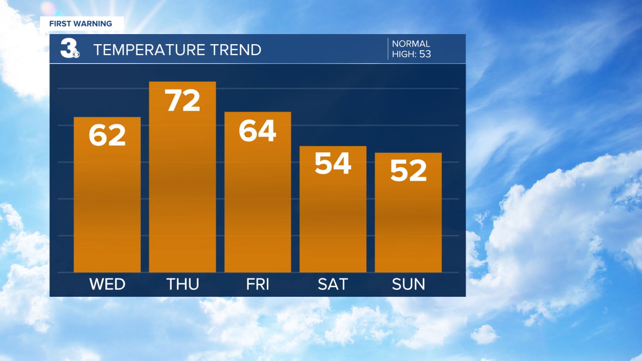
The warm-up we've all been waiting for is about to begin. After 10 out of the last 15 days in February were cold and below normal, we're set to end the month warm and above normal!

Highs will soar to the 60s and 70s over the next few days before a strong cold front knocks us back down to the 50s for the weekend.
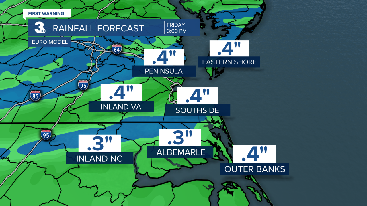
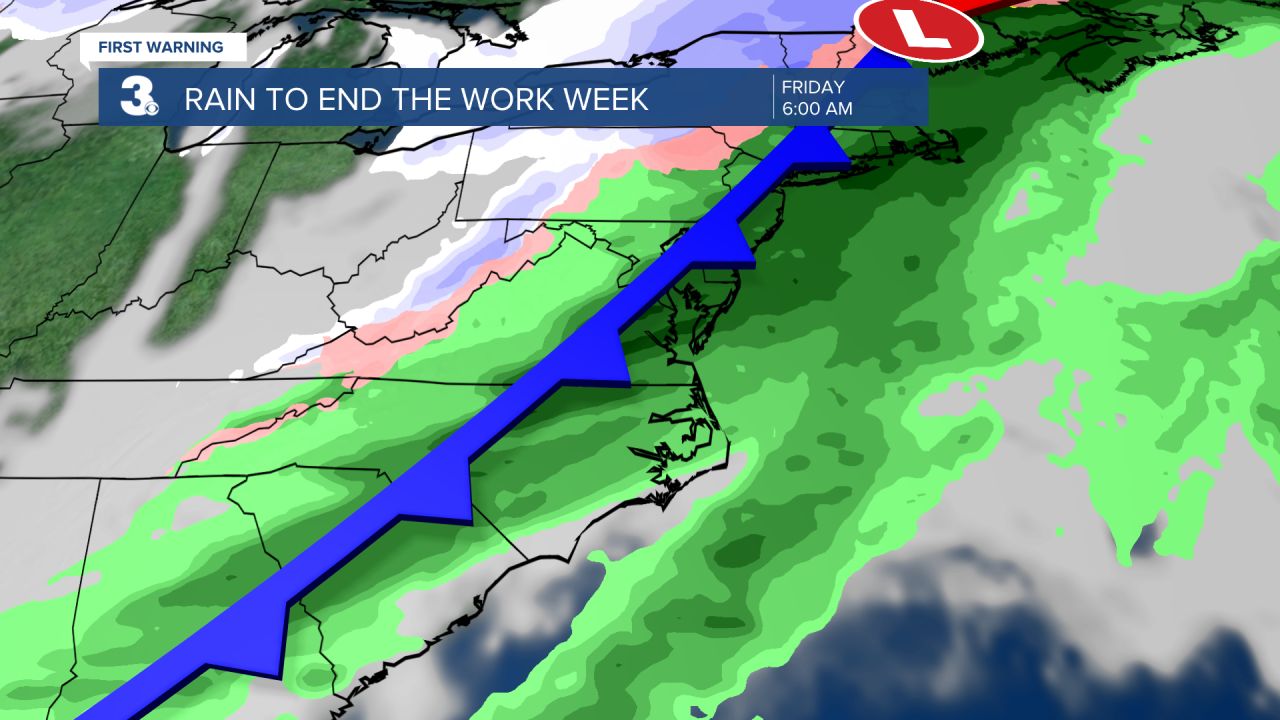
Speaking of the cold front, it will not only will knock our temperatures down, but also give us some rain. Due to the timing of it's passage, interaction with mountains and overall storm movement we're not anticipating severe weather when it rolls through Thursday night and into Friday. But we cannot rule out the sound of thunder as instability should be just enough to produce one or two storms.
The system isn't looking like a complete washout either. Most models paint between .10" to .50" through Friday at 3pm, with most of that rain falling early Friday morning before daylight.