

Meteorologist Tony Nargi's First Warning Forecast
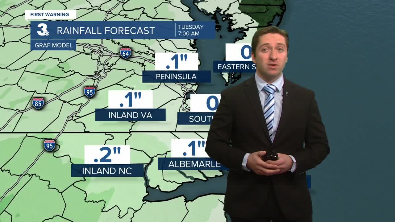
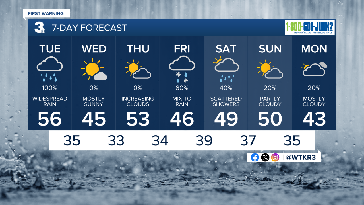
Don't forget that umbrella today! This morning rain will move in before sunrise, with light rain becoming steady to heavy rain at times between 8 am to 11 am. After lunchtime steady rain will turn to showers, with clearing expected to begin around sunset. High temperatures will reach the low to mid 50s, with winds out of the E at 5-10 mph, turning out of the NW at 10-15 mph. Temperatures will drop into the 40s quickly as winds turn from E to NW this afternoon. Rainfall will total between 1 to 1.5 inches, with locally heavier amounts possible on the Outer Banks. Overnight skies will clear with temperatures dropping into the 30s.


Tomorrow will be mostly sunny and chilly, with highs in the mid 40s. Winds will be out of the NW at 5-15 mph. Overnight will be chilly as temperatures will drop into the upper 20s to low 30s. Thursday will be a bit milder, with highs reaching the upper 40s to low 50s. Mostly sunny skies early on Thursday will transition to mostly cloudy skies by the afternoon.
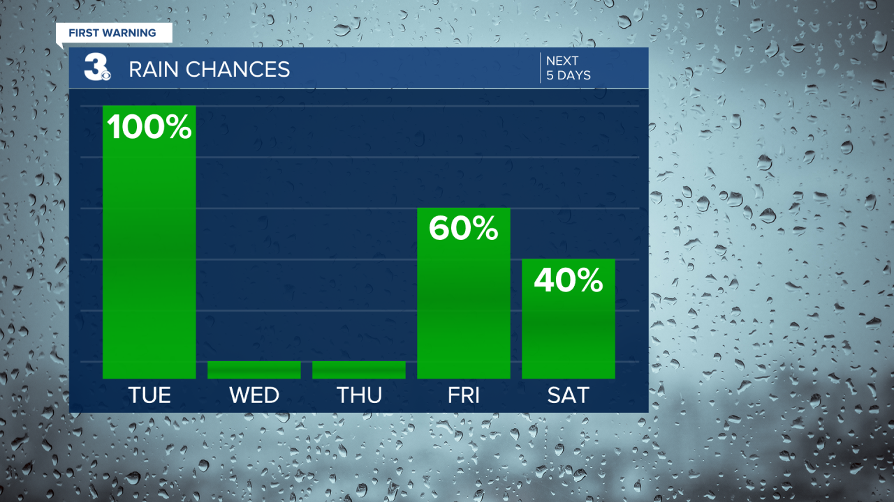
Our next system moves in on Friday as this active stretch of weather continues. Some wet snowflakes or rain/snow mix is possible Friday morning for inland areas, changing over to a cold rain during the afternoon. High temperatures will stay in the 40s with showers lingering into Saturday.
Weather updates on social media:
