

Meteorologist Tony Nargi's First Warning Forecast
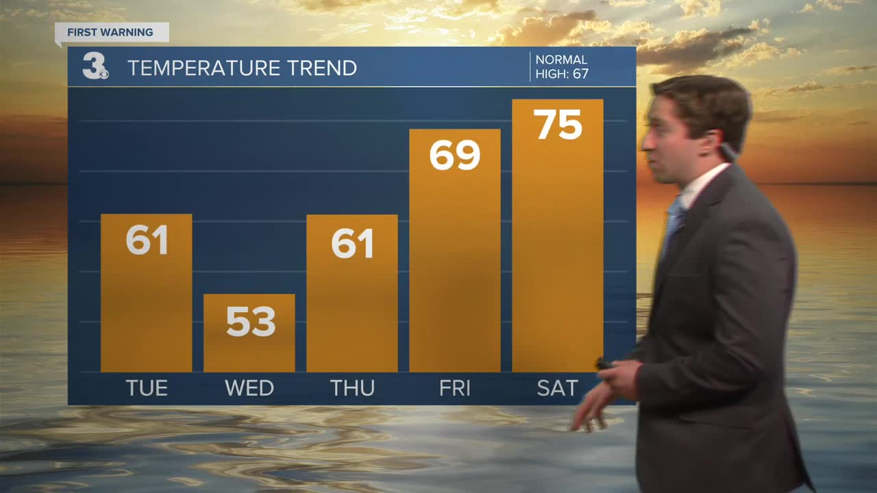
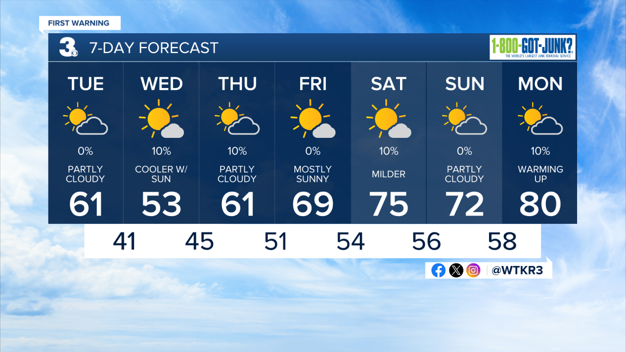
Today will start off mostly cloudy with some clearing expected later today. High's will be in the 50s along the immediate coast, with low to mid 60s inland. Winds will be breezy out of the NE at 10-20 mph. Overnight will be chilly, with lows dropping into the 30s and low 40s. Some patchy frost is possible, and a freeze warning may be put in place for far inland areas.


Tomorrow will be chilly ,with highs only reaching the low to mid 50s. It will be another breezy day, with winds out of the NE at 10-20 mph along with mostly sunny skies. A stray shower is possible on the Outer Banks, but most of our area will stay dry. Overnight lows in the 40s and isolated 30s inland may lead to some patchy frost.

Dry weather remains persistent over the next 7+ days. We'll see temperatures slowly warm back up later this week, with 70s by the weekend and 80s making a return by next week.
Weather updates on social media:
