First Warning Forecast:
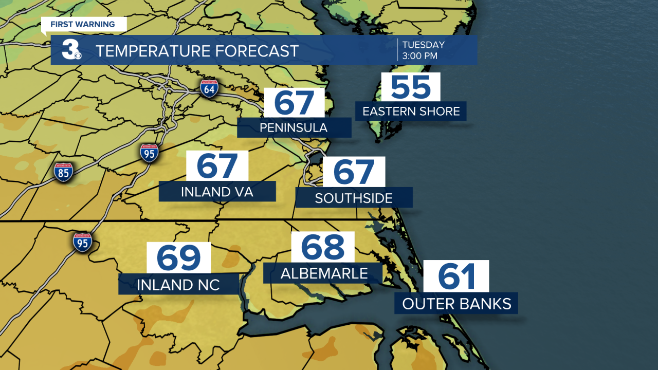
Dense fog could be an issue Tuesday morning as many of us head back to work and school. After the fog evaporates, our Tuesday will be breezy with spotty showers possible and otherwise mostly cloudy skies. It will be very warm with highs near 70.
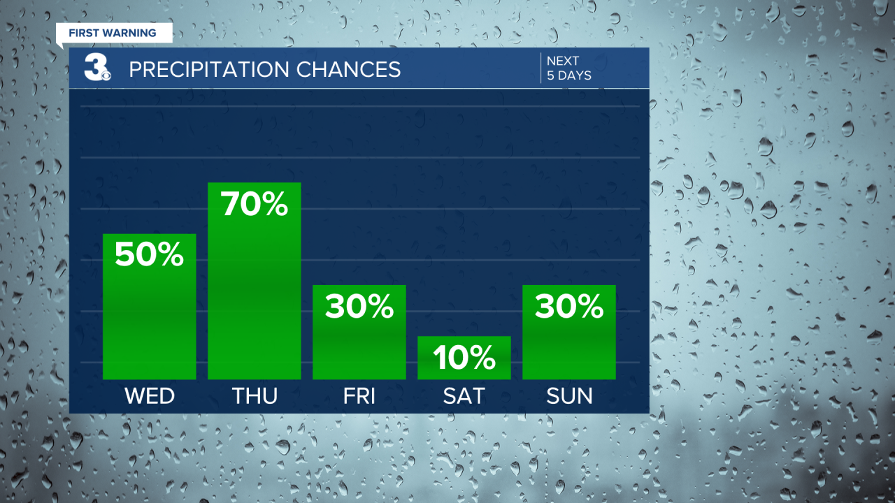
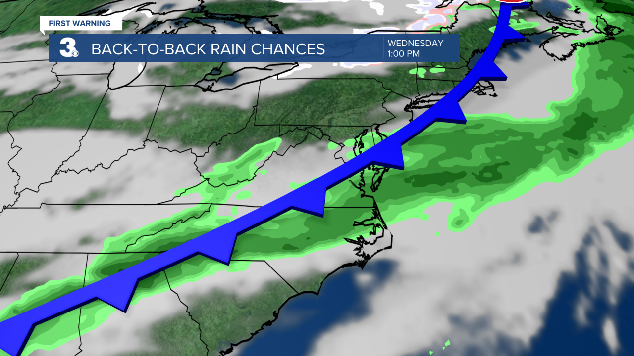
We'll enter an unsettled weather pattern starting Wednesday. Several disturbances will move through the area through the end of the week bringing a chance for showers. Rain chances will be highest Wednesday and Thursday. It will be much cooler Thursday with highs in the upper 40s and low 50s. Another warm up on Friday with highs in the upper 60s.
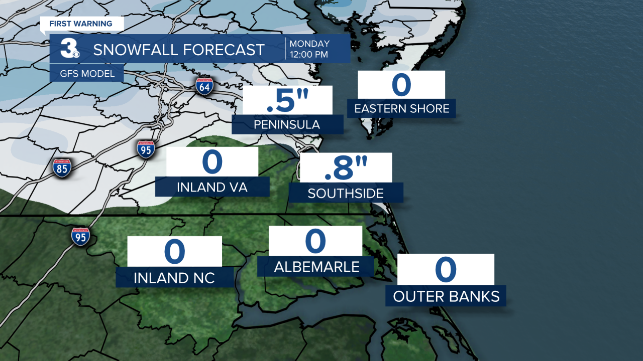
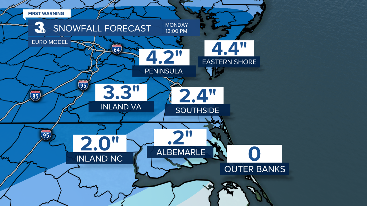
Behind Fridays rain chance will be another drop in temperatures. This drop (could) set the stage for accumulating snow. Timing/location/amounts are quite frankly all over the place. But if we advance the models starting Sunday through Monday afternoon as you see below, some of us would have accumulating snow by Monday afternoon. This is something we are monitoring, but nothing we're overly convinced about just yet. We'll keep you posted.