

Meteorologist Tony Nargi's First Warning Forecast
Today will be hot, with high temperatures reaching the mid to upper 80s this afternoon. It will be mostly sunny this morning, with partly cloudy skies this afternoon. Winds will be out of the SW at 10-15 mph. Overnight lows will only drop into the 60s, with winds picking up overnight out of the S at 10-20 mph.

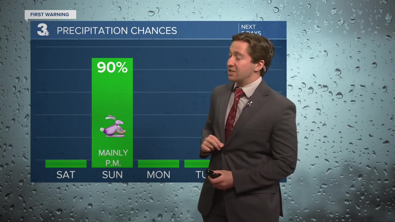
Easter Sunday (tomorrow!) will be warm and windy to start the day, with dry conditions expected during the morning. High temperatures will reach the mid 70s to low 80s, with w a cold front moving through during the afternoon. Along the cold front, a line of thunderstorms will develop and push through, with thunderstorms expected to develop after 12 pm and move through from west to east through 10 pm. Isolated storms could produce damaging wind gusts, keep an eye on the radar if you plan on traveling or have any outdoor activities tomorrow afternoon! It will be windy, with winds out of the SW at 10-20 mph gusting up to 30 mph.


Monday will begin a break from the warm weather, with high temperatures staying in the 60s. Dry conditions are expected for much of next week, with mostly sunny skies expected Monday along with winds out of the NE at 10-15 mph. Tuesday will be in the upper 50s to low 60s, with partly cloudy skies. Temperatures drop again on Wednesday, with dry conditions expected for the rest of the week. Milder weather is expected towards the end of next week.

Weather updates on social media:
