


Derrah Getter's First Warning Forecast
The patchy fog burns off this morning and some clouds mix on out with the daytime heating. Highs reach the upper 80s. A few isolated storms will be possible during the afternoon.

Daily storm chances linger through the work week. Highs hover in the low 90s starting Monday afternoon. By the end of the week high temperatures reach the mid 90s with feels like temperatures near 105.

With the high heat and humidity, any storms we see develop this week could turn strong to severe. Damaging winds, heavy downpours and hail will be our biggest threats with the strongest storms.

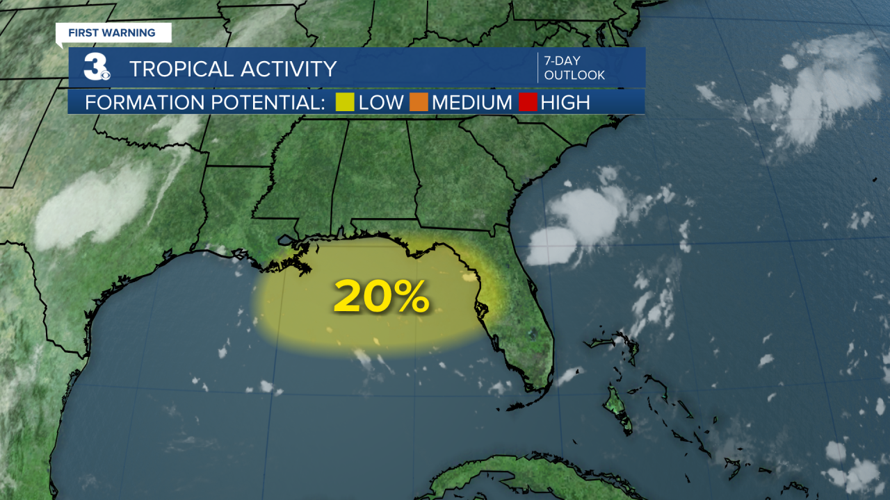
2025 Atlantic Hurricane Season Update - 7/13, 8 am:
A trough of low pressure is forecast to form in the Gulf. Chances for development are low as of now. Regardless of development the southeastern Gulf states are anticipated to experience heavy rainfall this week.
Let's connect on social media!
Forecaster Derrah Getter:
For weather updates on Facebook: HERE
For weather updates on X: HERE
Follow me on Instagram: HERE
Check out the Interactive Radar on WTKR.com: Interactive Radar
