



Meteorologist Tony Nargi's First Warning Forecast
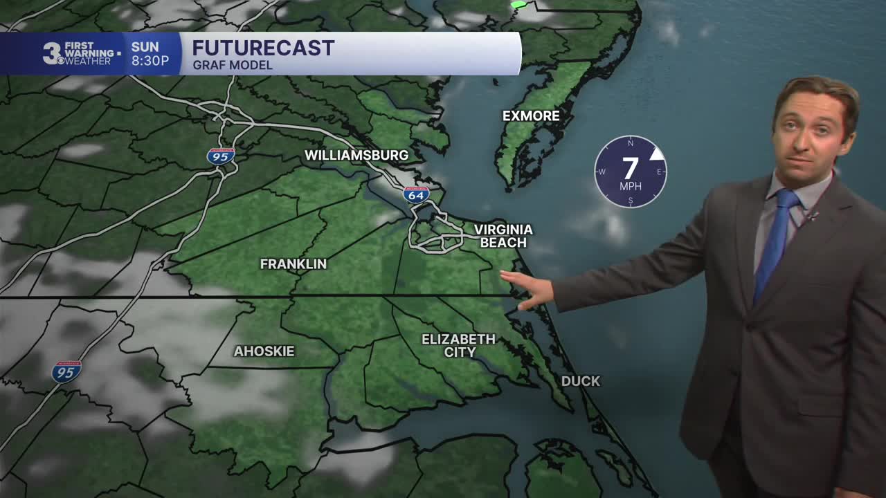
Scattered thunderstorms capable of producing severe weather, particularly in North Carolina (where a severe thunderstorm watch is in place until 10 PM), will last through the early evening. After 9 PM storms will fade, with lingering showers possible through 4 AM. Dry conditions emerge by dawn, with lows falling into the upper 60s and low 70s.


Tomorrow will be excellent, with partly cloudy skies and just a 20% chance of a stray shower. We'll see much lower humidity on Sunday, with dew points dropping well below 70 degrees. High temperatures will reach the low 80s, with winds out of the NE at 5-15 mph. Overnight lows will drop into the 60s and low 70s with skies clearing out.
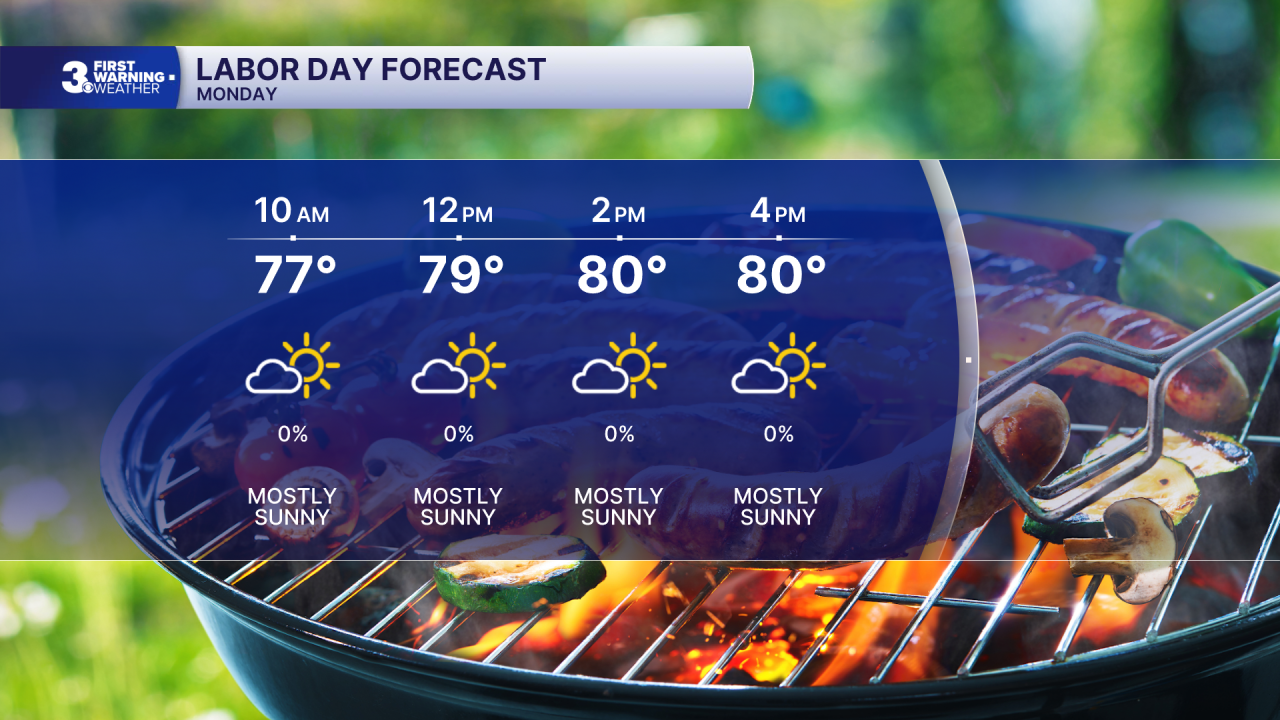
Labor Day will be picture-perfect, with mostly sunny skies along with low levels of humidity. High temperatures will reach the upper 70s to low 80s, with a light breeze out of the NE at 10-15 mph. The pleasant weather with lower humidity will carry over into Tuesday, with high temperatures in the low 80s along with mostly sunny skies.

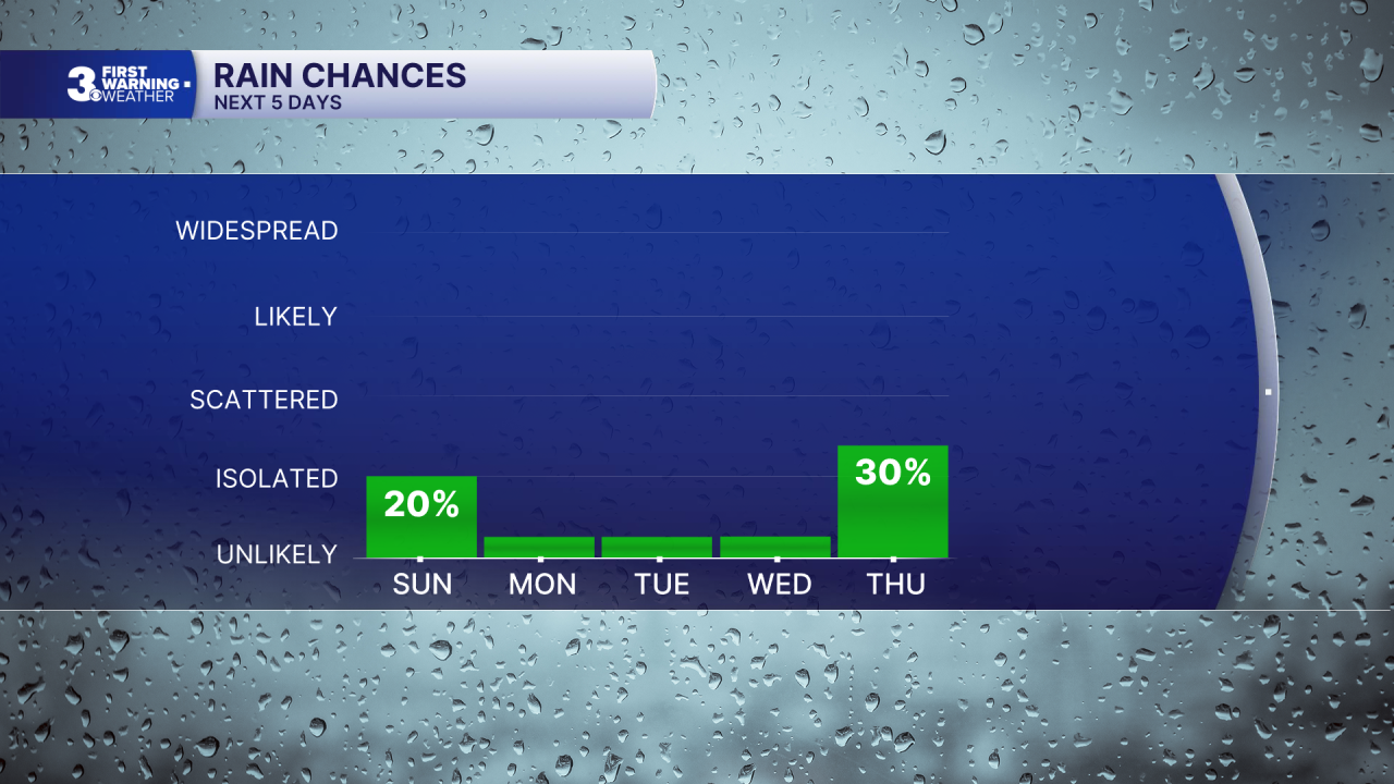
Dry conditions will continue into Wednesday, with temperatures trending upwards into the upper 80s by Wednesday afternoon. Thursday will be hot and humid with temperatures returning to the 90s. The heat is short lived though, with a cold front moving through Thursday night bringing some storms to the region along with cooler weather by Friday and Saturday.

TROPICS:

All quiet! Stay tuned for updates.
Weather updates on social media:
