



Meteorologist Tony Nargi's First Warning Forecast
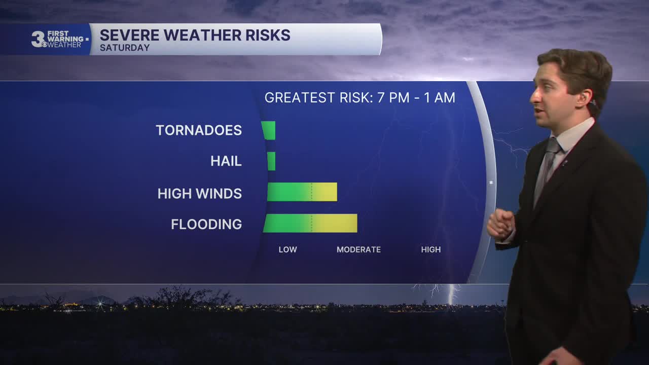
This morning will start off with some clouds along with isolated showers/sprinkles. Today will be mainly dry during the daytime, with partly cloudy skies and humid conditions expected. High temperatures will reach near 90 degrees, with winds out of the NE at 5-10 mph. Thunderstorms are possible after 6 PM, with more widespread storms expected overnight. Isolated severe storms are possible, with localized flooding, frequent lightning, and severe gusts up to 60 mph possible. Lows will drop into the 70s.


Tomorrow will start off cloudy with occasional showers and thunderstorms. Storms will continue into the afternoon but should slowly taper off after 3 PM. We'll see mostly cloudy skies along with high temperatures in the low to mid 80s. Winds will be out of the ENE at 5-15 mph. Overnight lows will drop into the upper 60s to mid 70s. Monday will feature more rain, with showers expected in the morning followed by showers and occasional storms/downpours in the afternoon. It will be cooler, with high temperatures in the low 80s. Winds will be gusty out of the ENE at 10-20 mph.
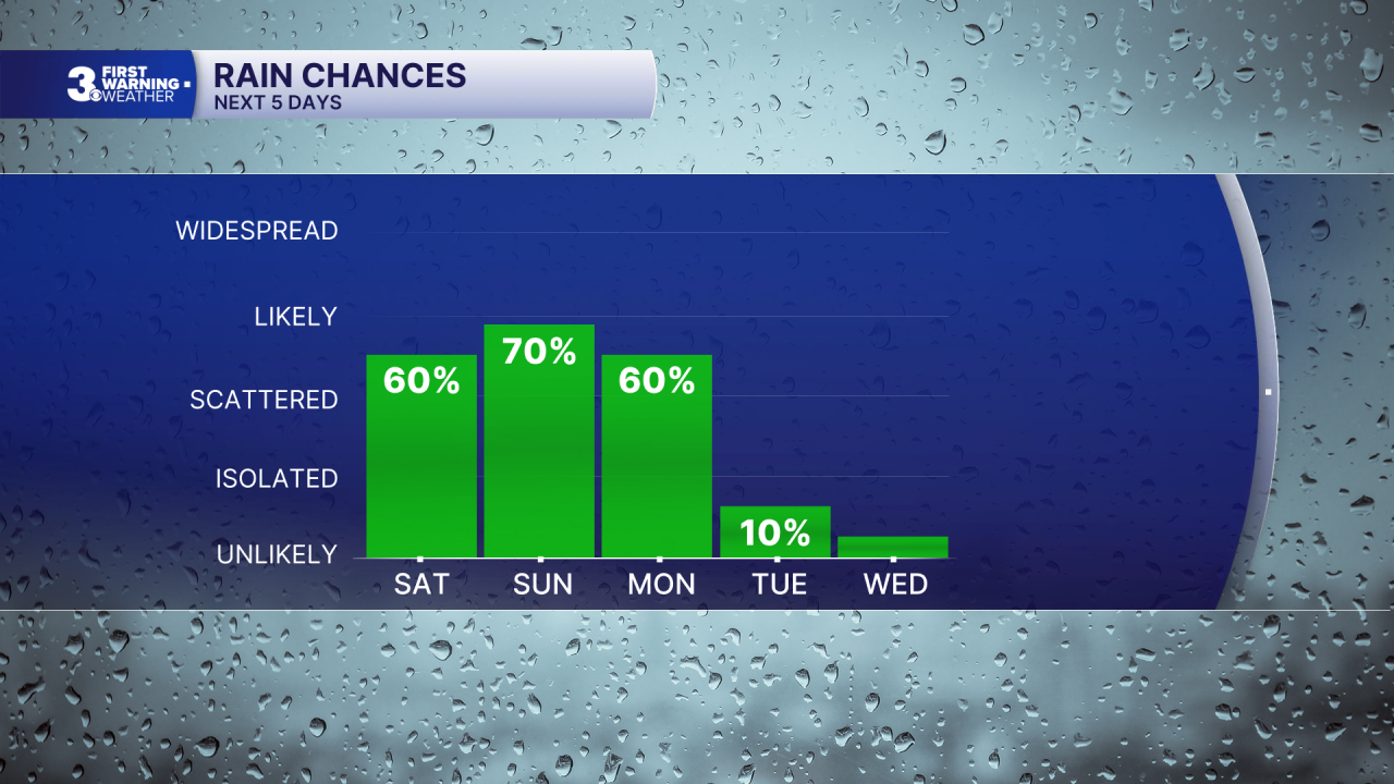

On Tuesday drier conditions are expected, with comfortable temps in the mid 80s along with partly cloudy to mostly sunny skies. Dry conditions carry over into Wednesday, with mostly sunny skies expected. Temperatures will jump into the 90s on Wednesday and Thursday, with heat indices surpassing 100 and mainly dry conditions expected. Friday looks interesting, with heat and humidity building ahead of a unseasonally strong cold front that will approach. Strong storms are possible Friday afternoon. Details will become clearer as we get closer to the end of next week.

Weather updates on social media:
