


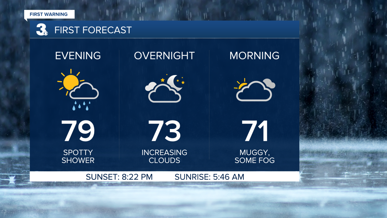
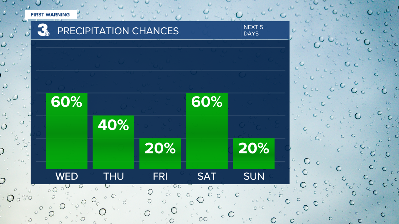
First Warning Forecast:
Our gorgeous, dry and comfortable stretch is about to end. We're tracking storms, potentially severe, heading into our Wednesday. Patchy fog will be possible by early Wednesday morning.
WTKR Weather
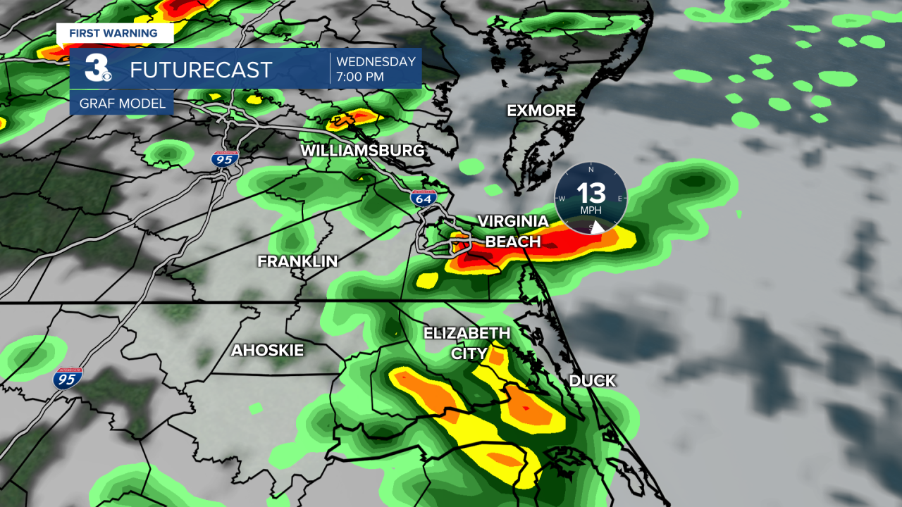
We'll start our Wednesday with mainly cloudy skies but we will see sunshine before the storms arrive in the afternoon and evening.
WTKR Weather
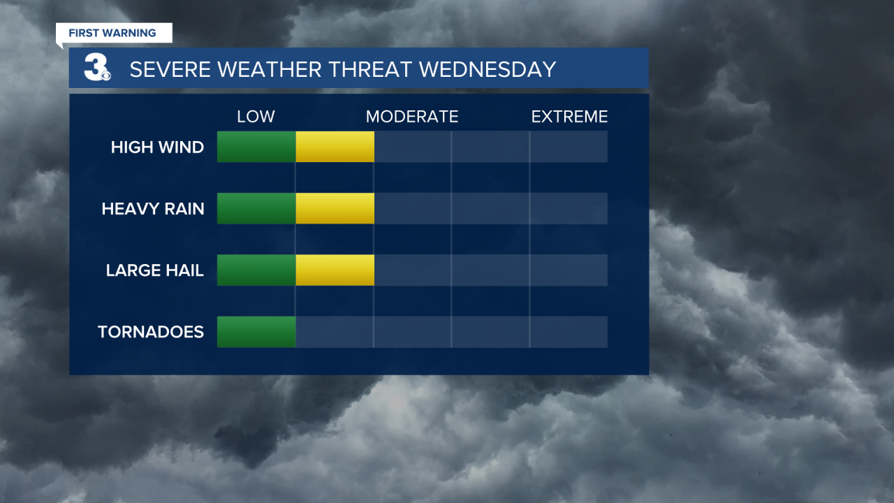
That added sunshine around lunchtime could help make tomorrows storms severe, with damaging wind gusts, localized flooding, and pockets of hail possible.

WTKR Weather
WTKR Weather
WTKR Weather
It will be warm and muggy, with highs in the upper 80s to near 90.
WTKR Weather
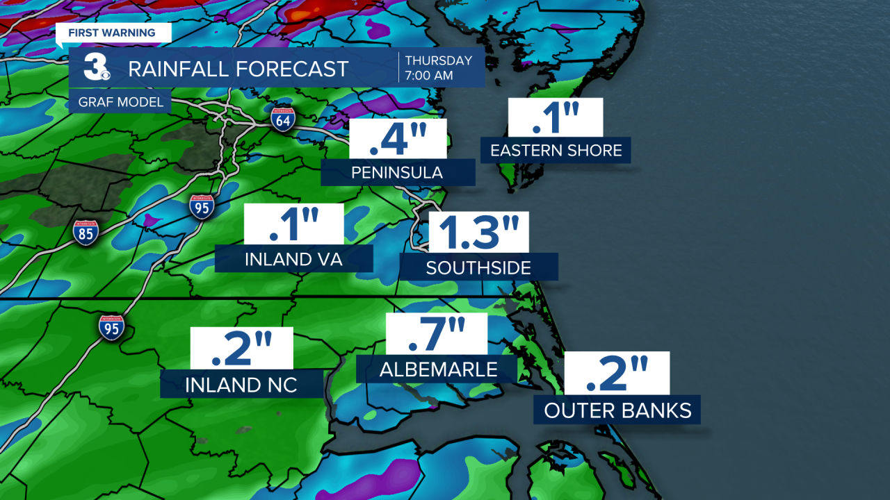
As the cold front moves out of our area Thursday, we could have a few lingering showers Thursday morning. We'll dry out for the rest of our Thursday and generally dry on Friday.
