


First Warning Forecast:
Get ready for a bumpy ride this week with rounds of storms (some severe) and big swings in temperatures.
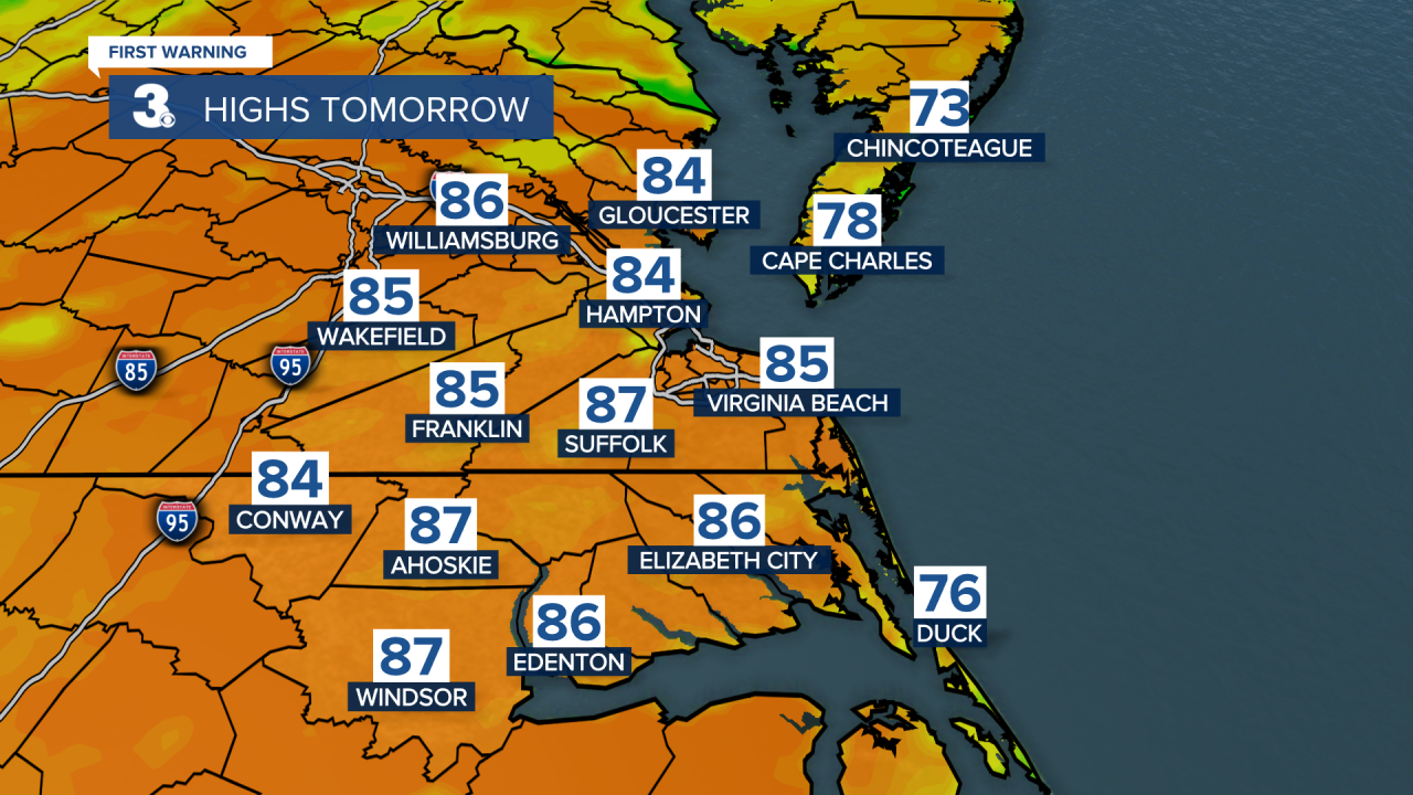
The hottest day of the week will be Wednesday. Highs will soar to the upper 80s. We'll start the day with a mix of partly to mostly cloudy skies but another round of storms will move in mainly in the afternoon to evening (3 PM to 8 PM).
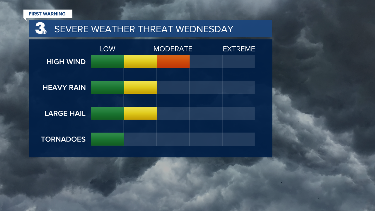
Some storms Wednesday could be strong to severe with damaging winds, hail and heavy rain our biggest threats.

Rain chances will be lower for Thursday but it will be noticeably cooler with highs in the upper 60s to near 70. Skies will be mostly cloudy.
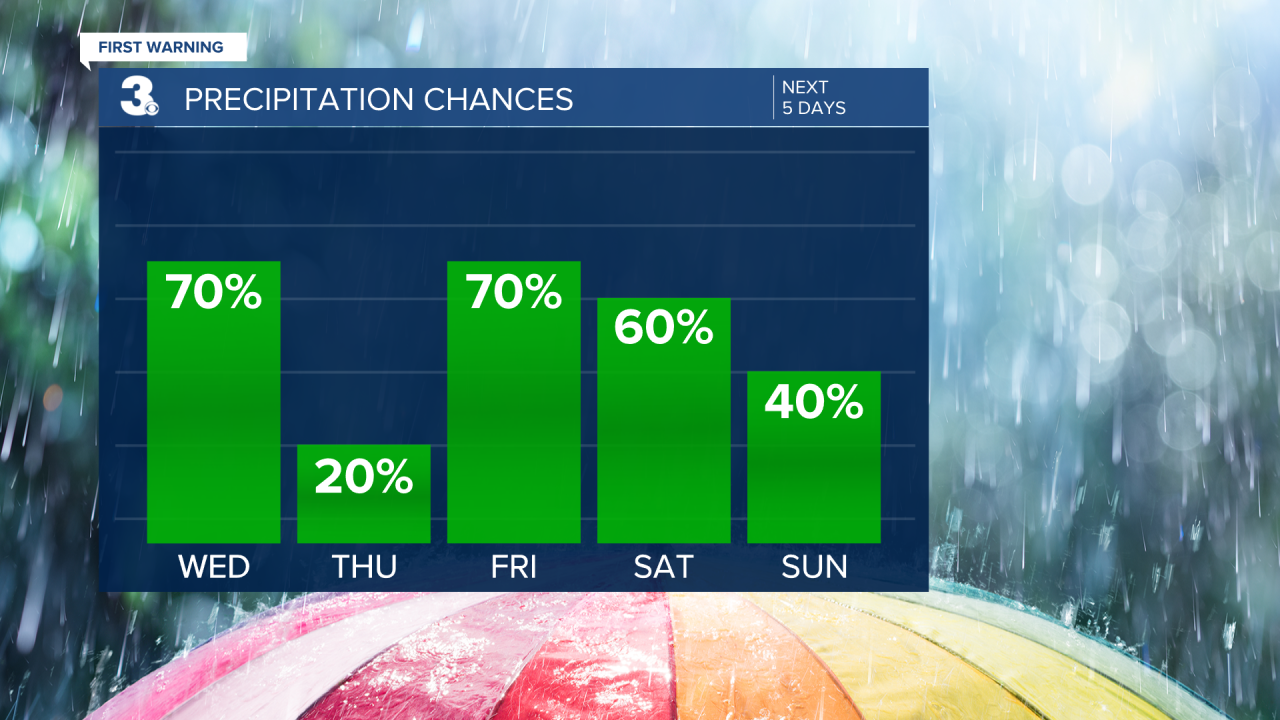
Rain returns for Friday and the Mother's Day weekend as an area of low pressure slowly moves over the Mid-Atlantic. Highs will be cooler, in the 60s and 70s. Highest rain chances will be Friday and Saturday with cloudy skies and afternoon showers on Sunday.
