First Warning Forecast:
After a busy evening with strong and severe storms, our overnight hours will be much quieter. Expect decreasing clouds with comfortable low temperatures in the upper 50s to near 60.
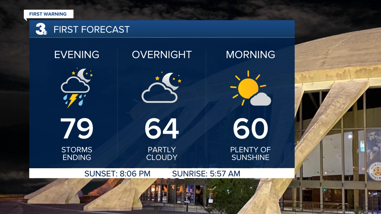
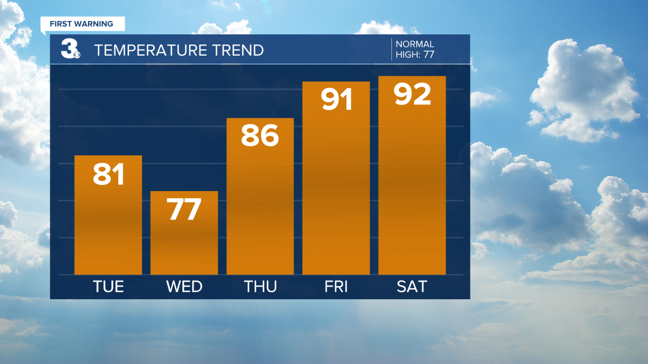
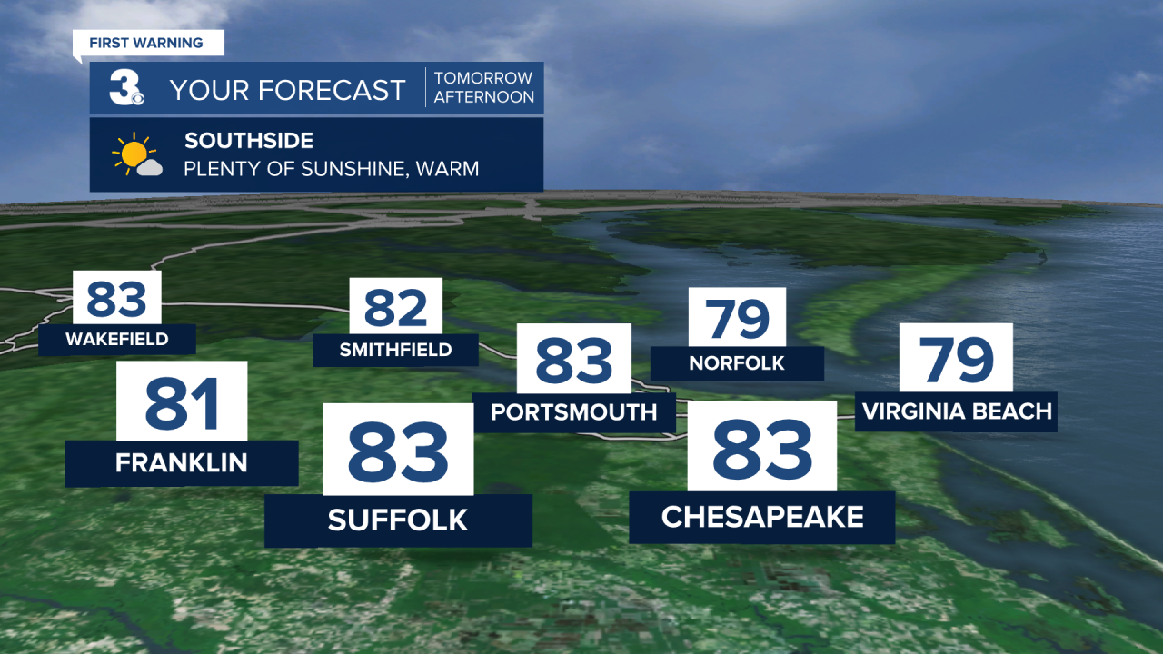
High pressure will slide in for our Tuesday which will result in a gorgeous day. Skies will be mostly sunny, it'll be less humid and highs will climb to the low 80s. A dry cold front will move sneak in Tuesday night which will drop our highs even more Wednesday.
Wednesday will start sunny with clouds building during the afternoon. Highs Wednesday will be in the upper 70s, near normal for this time of year. Our next storm chance arrives Thursday as a warm front lifts north through the area. This will lead to off and on showers and storms with warmer highs in the upper 80s.
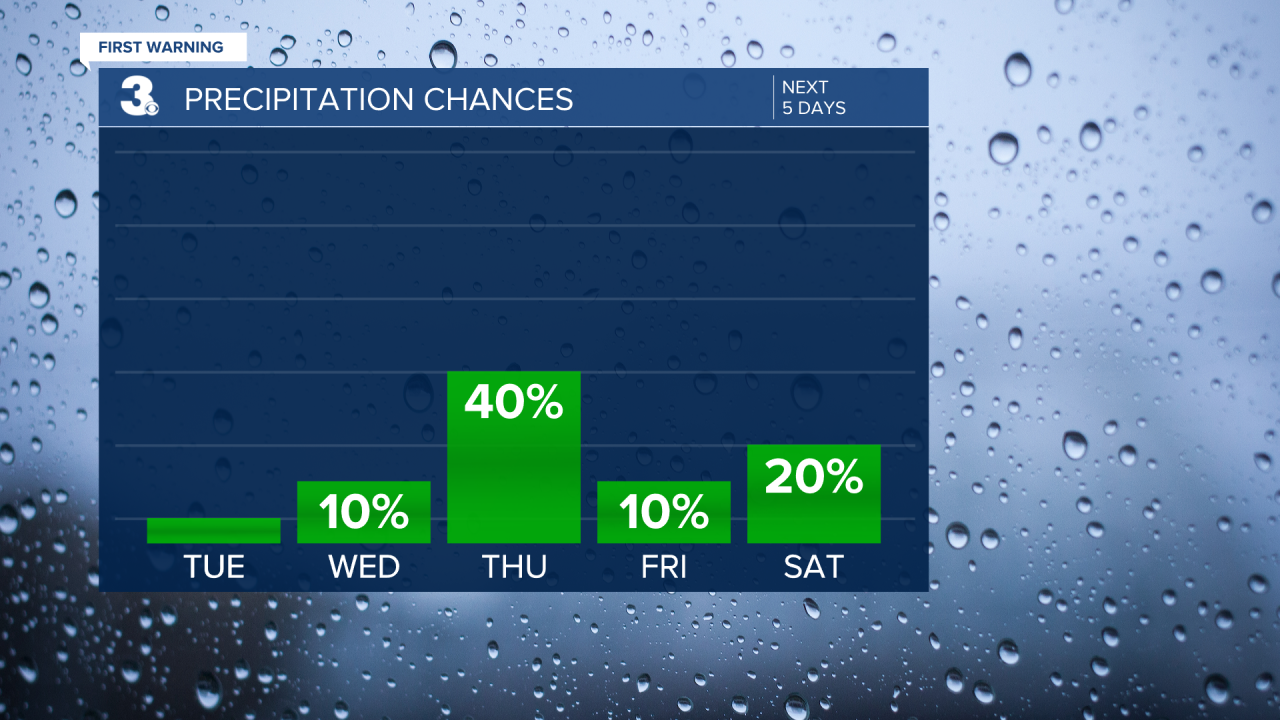
Temperatures will continue to soar making it feel like summer to end the week. Highs will climb to the low 90s Friday and Saturday with mostly sunny skies Friday and partly cloudy skies Saturday. Also, we cannot rule out an afternoon storm Saturday thanks to the higher humidity and daytime heating.