
Meteorologist Tony Nargi's First Warning Forecast
This morning will start off muggy and warm along with a mix of sun and clouds. A stray shower or thunderstorm is possible this morning, with most of us staying dry until stronger storms move through this afternoon. High temperatures will reach the upper 80s to low 90s, with winds out of the SW at 5-15 mph. Strong to severe thunderstorms will develop around midday and move northwest to southeast during the afternoon, beginning around 2 PM with storms possible until around 8 PM. The main threat will be straight line wind gusts up to 70 mph. Overnight showers and storms will clear out, with lows in the 70s.


Tomorrow will start out with clouds and sunshine. Temperatures will reach the mid to upper 80s, with winds out of the NW at 5-10 mph. A few showers and storms will develop during the afternoon, with a 60% chance of rain expected. Severe storms are possible Sunday as well, but more isolated than Saturday. Clouds will linger overnight, with lows in the 60s and low 70s. Monday will start out cloudy with a few scattered showers possible in the morning. We'll see drier conditions by the afternoon and high temperatures in the low 80s.

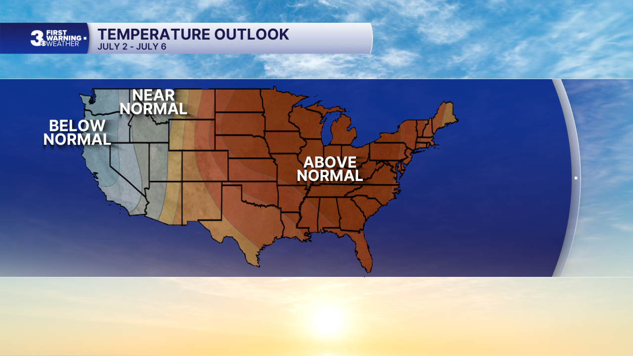
Tuesday will be mostly sunny with high temperatures in the mid 80s. We'll see a heat dome start to build into the region on Wednesday, with very strong signaling for a hot and humid July 4th weekend.

Weather updates on social media:
