

Meteorologist Tony Nargi's First Warning Forecast
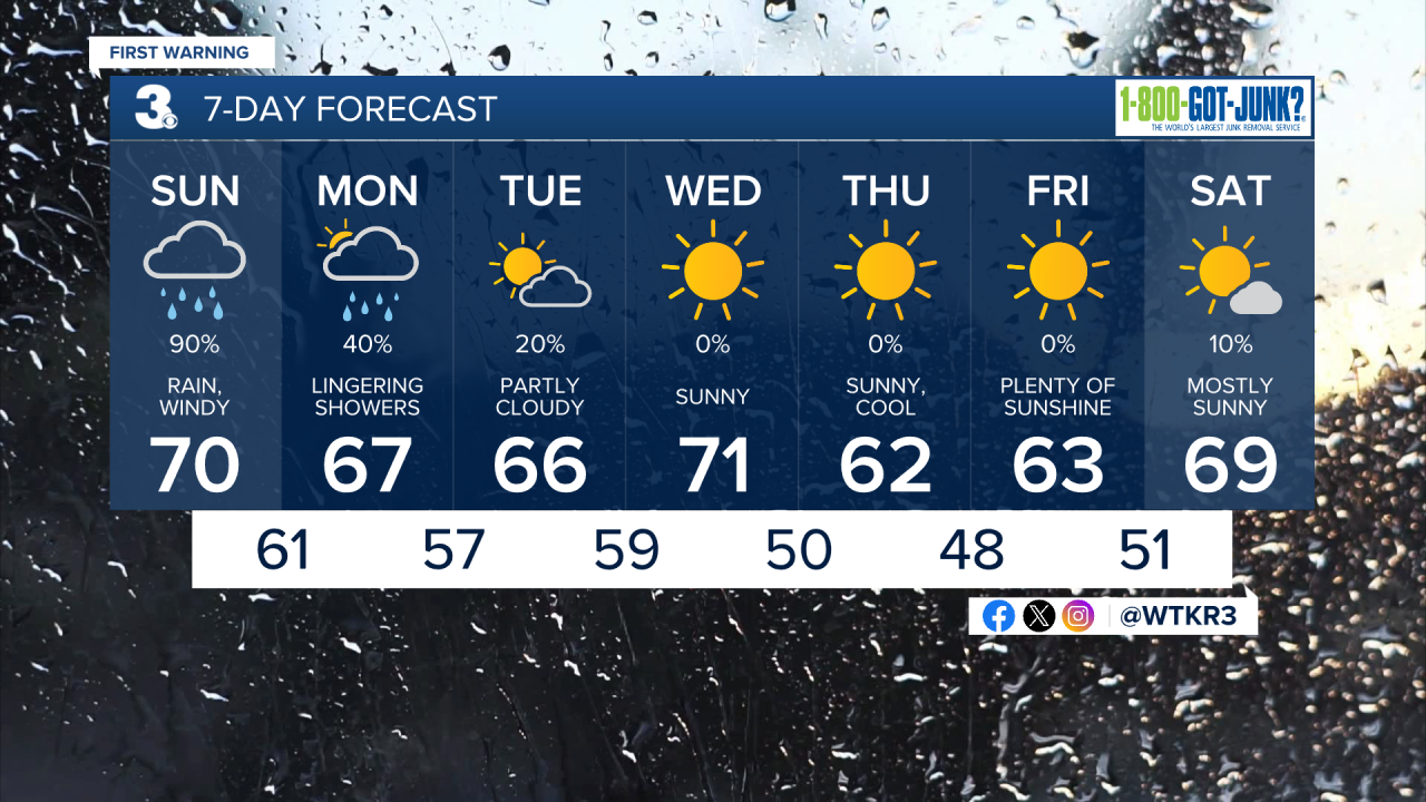
Strong wind gusts along with steady rain from a strong coastal storm will continue through this morning. Steady light rain will taper off to shower activity later this morning. Winds this morning out of the NE at 20-25 mph gusting to 35 mph will increase to 25-30 mph around midday, with gusts up to 40 mph possible. Some areas along the immediate coastline may see gusts that exceed 50 mph. Persistent strong NE winds will trigger coastal flooding this afternoon during the high tide cycle, a coastal flood warning is in effect from now until Monday morning. The Sunday afternoon high tide is expected to be the worst, with major tidal flooding possible. Moderate tidal flooding is possible overnight into early Monday AM. Highs on Sunday will stay in the upper 60s and low 70s. Additional rainfall totals will be light, between 0.1" and 0.5".


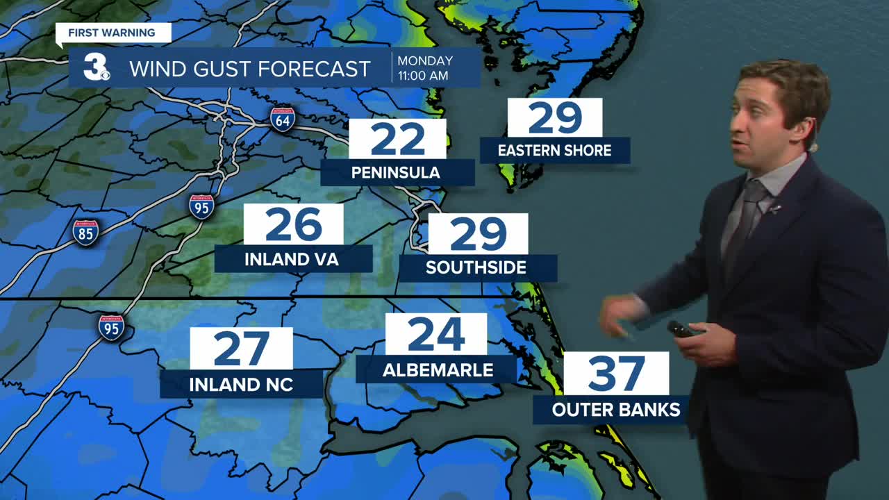
Tomorrow will be improved from today, with mostly cloudy skies along with a few lingering showers possible. Our winds will be lighter tomorrow, out of the NW at 10-20 mph with gusts up to 30 mph possible (higher OBX). Highs will be in the mid to upper 60s. Minor tidal flooding is possible Monday afternoon. On Tuesday a mix of sun and clouds are expected, with mainly dry weather besides a couple isolated afternoon sprinkles. Highs will be in the mid to upper 60s, with winds out of the N at 10-20 mph. Nuisance tidal flooding is possible on Tuesday.

By Wednesday next week high pressure takes over and sunshine is expected. It will be cooler than normal, with highs in the low 60s Thursday and Friday.
Weather updates on social media:
