


Meteorologist Myles Henderson’s First Warning Forecast
More sunshine and 60s to end the week. Cold air returns with a chance for snow on Sunday.
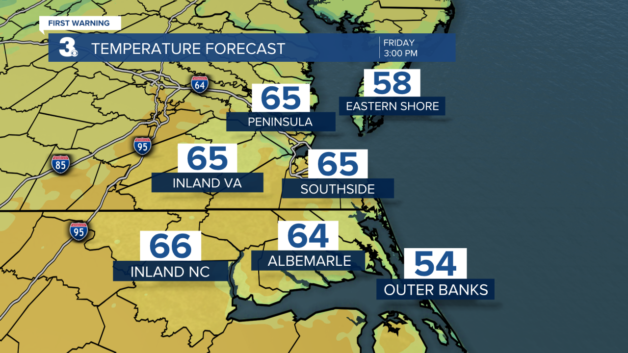
We will see another nice spring-like day. Expect mostly sunny skies with highs in the mid 60s today, about 10 degrees above normal for this time of year. Saturday will be the warmest day of the week with highs in the mid to upper 60s. Most of Saturday will be sunny, but clouds will build in late in the day as our next weather maker moves in.
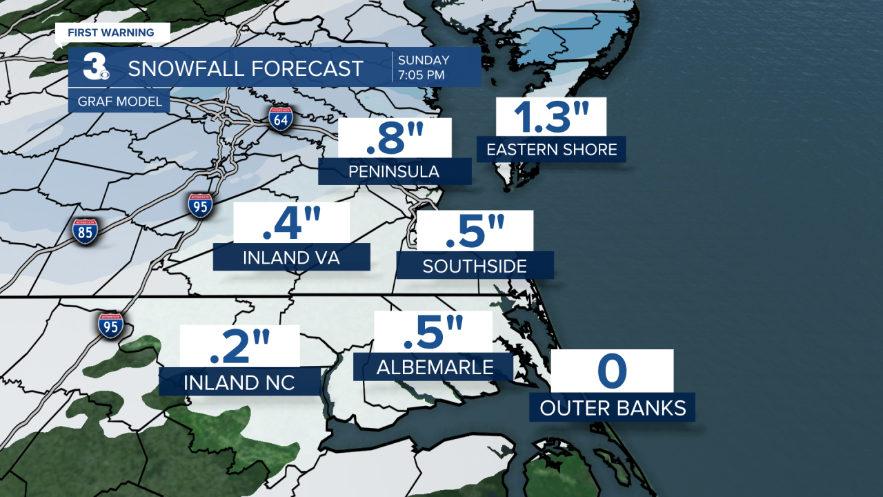
A cold front is set to move through the region Saturday night to Sunday. Scattered rain/snow showers are likely throughout the day Sunday as temperatures will fall from near 40 Sunday morning to the 30s. This will not be a huge snow event for us, with accumulations between 0” and 1”. Areas to the northwest will be closer to the 1” mark and areas to the southeast closer to 0”. Winds will also ramp up Sunday, NW at 10 to 20 with higher gusts.
Cold air sticks around early next week. Temperatures will start in the 20s Monday morning with a wind chill in the upper teens. Highs will only reach the upper 30s Monday afternoon.
Today: Mostly Sunny, Warmer. Highs in the mid 60s. Winds: SW 5-15
Tonight: Mainly Clear. Lows in the mid 40s. Winds: SW 5-10
Tomorrow: Late-Day Clouds. Highs in the mid to upper 60s. Winds: SW 5-10
Weather updates on social media:
Facebook: MylesHendersonWTKR
Twitter: @MHendersonWTKR
Instagram: @MylesHendersonWTKR
