


Meteorologist Myles Henderson’s First Warning Forecast
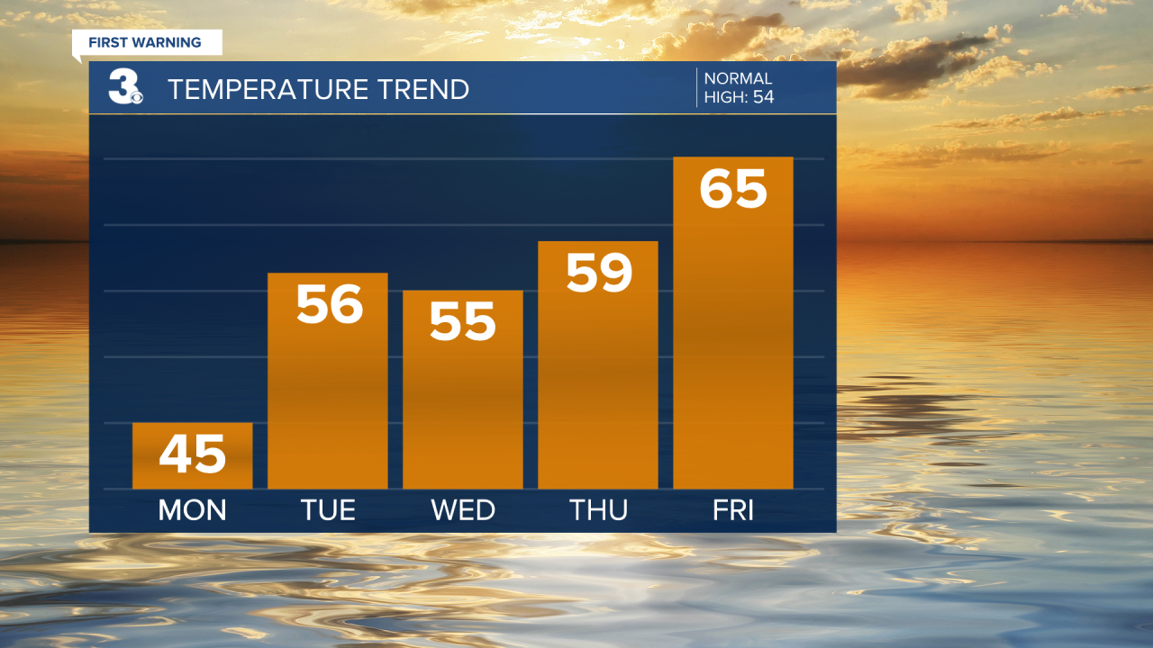
Warming from the 40s to the 60s this week. Scattered showers Tuesday morning. Highs in the 50s for Christmas.
Lots of sunshine today with highs in the mid 40s, about 10 degrees below normal for this time of year. Clouds will build in this evening and tonight with lows dropping into the mid 30s.

Mostly cloudy with scattered showers tomorrow morning. Clearing skies tomorrow afternoon with highs in the mid 50s, near normal.
Very nice weather for Christmas Eve. Mostly sunny to partly cloudy skies with highs in the mid 50s.
A mix of partly to mostly cloudy skies for Christmas Day with a spotty shower possible. Highs will warm to the upper 50s. We will warm to the 60s on Friday.

Today: Mostly Sunny. Highs in the mid 40s. Winds: NE 5-15
Tonight: Building Clouds. Lows in the mid 30s. Winds: S 5-10
Tomorrow: Morning Showers, Afternoon Clearing. Highs in the mid 50s. Winds: SW 10-20
Weather updates on social media:
Facebook: MylesHendersonWTKR
Instagram: @MylesHendersonWTKR
