

Meteorologist Tony Nargi's First Warning Forecast
Today will be an excellent fall day, with seasonable high temperatures in the 70s along with dry conditions expected. We'll see mostly sunny skies with light winds out of the E at 5-10 mph. Dew points will be in the low 60s, so humidity won't be much of a factor today. Overnight temperatures will drop back down into the 50s and low 60s, with some more patchy fog possible. Surf will be between 3 and 4 feet, with a high risk of rip currents.

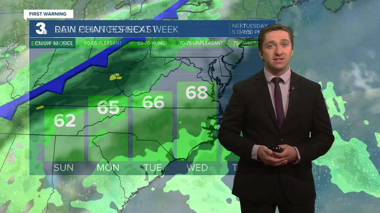
Tomorrow will be another good day, with high temperatures reaching the upper 70s and low 80s. It will be mostly sunny again along with winds out of the ENE at 5-10 mph. Dew points will climb into the mid 60s, as humidity slowly returns. On Tuesday we'll see partly cloudy skies along with highs in the upper 70s to mid 80s. Winds will be out of the S at 5-10 mph. Dew points will reach the upper 60s by Tuesday.


On Wednesday a cold front will move through, with highs in the mid 70s to near 80 along with showers and isolated storms expected, mainly during the afternoon. Behind the cold front our temperatures will drop into the 60s on Thursday, with clearing skies expected. A low-end chance of showers will persist into Friday and Saturday.

TRACKING THE TROPICS
A tropical wave moving over the main development region of the Central Atlantic now has a 60% chance of development over the next week. This is the only area of concern in the tropics right now. Some development may be possible in the gulf over the next couple of weeks, but right now that chance remains low. Stay tuned for updates!

Weather updates on social media:
