


Meteorologist Myles Henderson’s First Warning Forecast
Sunshine for Christmas Eve, more clouds and showers for Christmas Day.
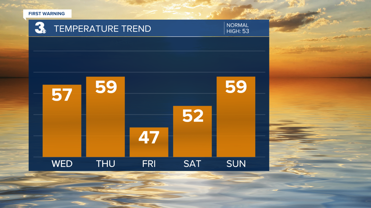
Today may be the nicest day of the week. Highs will return to the mid and upper 50s, a few degrees above normal for this time of year. We will see mostly sunny skies with a slight breeze picking up. Clouds will build in tonight with lows falling into the 30s.

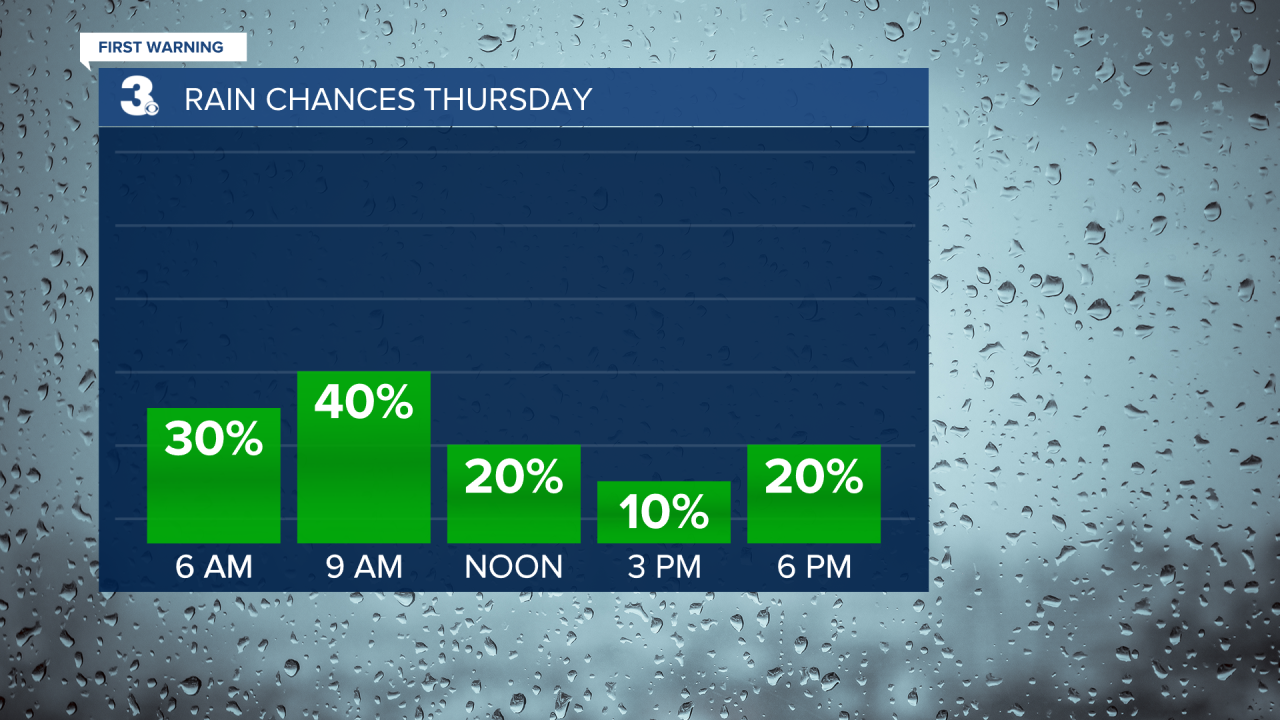
Look for a mix of partly to mostly cloudy skies for Christmas Day with scattered showers, mainly in the morning. Highs will return to the upper 50s.
We will see a mix of clouds on Friday with showers returning later in the day. Highs will dip to the upper 40s.
The weekend looks nice. Highs will climb from the low 50s on Saturday to the upper 50s on Sunday. Expect partly cloudy skies on Saturday with a slim rain chance. Cloud cover will increase and rain chances will go up to end the weekend.
Today: Mostly Sunny. Highs in the upper 50s. Winds: N 5-15
Tonight: Partly Cloudy. Lows in the upper 30s. Winds: NE 5-10
Tomorrow: Mix of Clouds, Scattered Showers. Highs in the upper 50s. Winds: SW 5-15
Weather updates on social media:
Facebook: MylesHendersonWTKR
Instagram: @MylesHendersonWTKR
