


Meteorologist Myles Henderson’s First Warning Forecast
Sunny and cool again today. Warming back to the 70s to end the week. Tracking rain and wind for the weekend.
Another nice but cooler day. Highs will only reach the low to mid 50s today, about 10 degrees below normal for this time of year. Expect mostly sunny skies with a NE breeze at 5 to 15 mph.

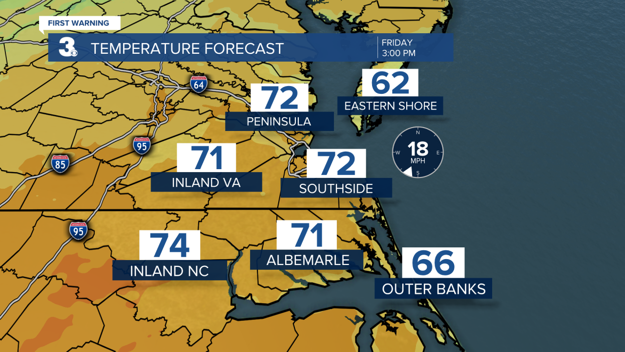
Warmer air returns on Friday with highs climbing to the low 70s. Clouds will build in through the day with scattered showers possible Friday night. Winds will pick up tomorrow, S/SW at 10 to 15 with gusts to 25 mph.
Clouds and rain on Saturday with an isolated storm possible. There is a “Level 1” severe threat for parts of eastern NC. It will be warm and very windy with highs in the mid 70s and wind gusts to 40+ mph.

We will see sunshine on Sunday with highs falling to the upper 50s. It will still be windy Sunday morning, but winds will start to relax through the day.
Today: Mostly Sunny. Highs in the mid 50s. Winds: NE 5-15
Tonight: Mainly Clear. Lows in the low 40s. Winds: E/S 5-10
Tomorrow: Building Clouds, Windy. Highs in the low 70s. Winds: S 10-15G25
Weather & Health
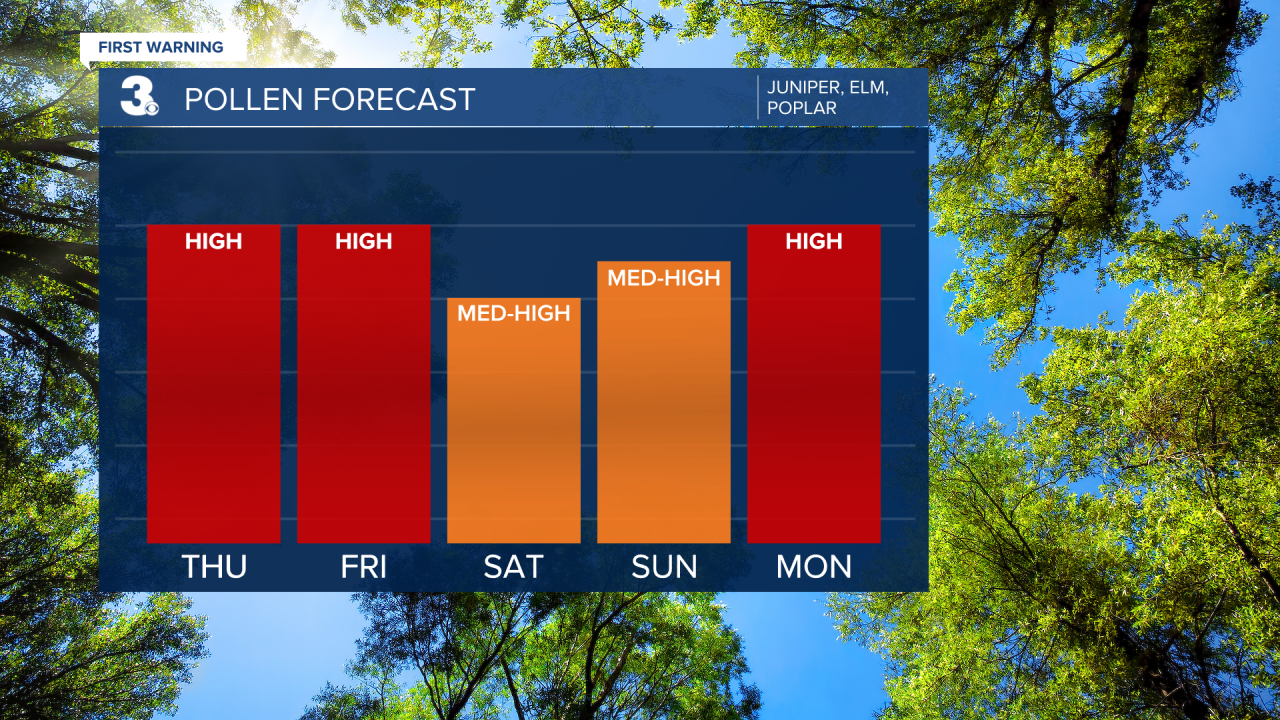
Pollen: High (Juniper, Elm, Poplar)
UV Index: 5 (Moderate)
Air Quality: Good (Code Green)
Mosquitoes: Low
Weather updates on social media:
Facebook: MylesHendersonWTKR
Twitter: @MHendersonWTKR
Instagram: @MylesHendersonWTKR
