


Meteorologist Maddie Kirker's First Warning Forecast:
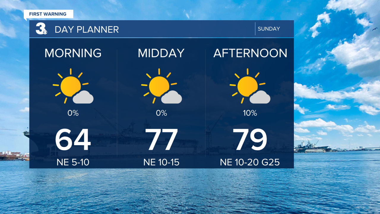
A gorgeous Sunday is on tap. Expect mostly sunny skies today with below normal highs in the upper 70s. Add this with the low humidity and you've got a wonderful feeling day. It'll also be a bit breezy this afternoon with east and northeast winds between 10 and 20 mph with gusts up to 25 possible.
Tropical Storm Alex formed early Sunday and is currently out over the open Atlantic racing to the northeast away from the United States.

As for what impacts we can see here: We are not expecting any direct impacts from the storm. With dew points in the 50s this afternoon, the air will be too dry for any rain to fall plus the system should stay south of us including our area in the Outer Banks. What we will see will be a rougher surf with waves between 2 and 4 feet and a moderate rip current risk today and a high rip current risk tomorrow.
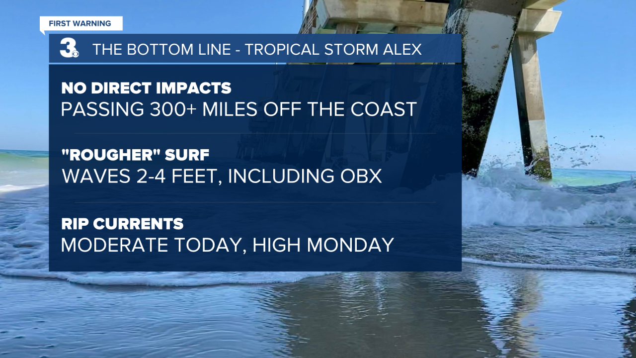
Technically speaking, Alex will be closest to our area early Monday morning. But again, the storm is hauling it out to sea, so we don't expect our ocean waters to stay angry for very long as a result.


Our chances for rain and storms begin to go up starting Tuesday afternoon along with our afternoon temperatures. Highs will climb back to the upper 80s starting Tuesday and humidity will increase as well. The highest chance of rain will be on Wednesday.
