


Meteorologist Myles Henderson’s First Warning Forecast
A drier and warmer week. Highs in the 70s & 80s through midweek, warming to the 90s by Friday.
Nice today with mostly sunny skies and highs in the low to mid 80s, about 5 degrees above normal for this time of year. Wednesday will be nice too, just a bit cooler. Expect highs in the upper 70s tomorrow with sunshine to start the day and clouds building in late in the day.
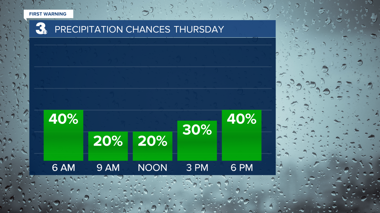
A warm front will lift through the region on Thursday, bringing in more clouds, a chance for showers and storms, and warmer air. Highs will reach the mid and upper 80s on Thursday with a mix of partly to mostly cloudy skies. Scattered showers and storms are possible throughout the day.
Get ready for a taste of summer to end the week. Highs will climb to the low 90s on Friday and the humidity will increase too. Expect mostly sunny skies on Friday. Highs will return to the low 90s on Saturday with partly cloudy skies. A typical summertime “pop-up” shower or storm is possible.
We are tracking a cold front for Sunday. Expect scattered showers and storms Sunday afternoon to evening. Cooler air will move in behind the front. Highs will fall back to the 70s on Monday.
Today: Mostly Sunny. Highs in the low 80s. Winds: W 5-15
Tonight: A Few Clouds. Lows in the low 60s. Winds: W/N 5-10
Tomorrow: Late-day Clouds. Highs in the upper 70s. Winds: N/E/S 5-10
Weather & Health
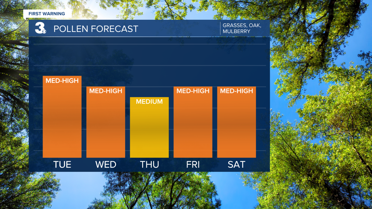
Pollen: Medium-High (Grasses, Oak, Mulberry)
UV Index: 9 (Very High)
Air Quality: Good (Code Green)
Mosquitoes: High
Weather updates on social media:
Facebook: MylesHendersonWTKR
Twitter: @MHendersonWTKR
Instagram: @MylesHendersonWTKR
