Meteorologist Maddie Kirker's First Warning Forecast:
Sunshine and flirting with 90° to end the weekend plus tracking our next threat of storms.
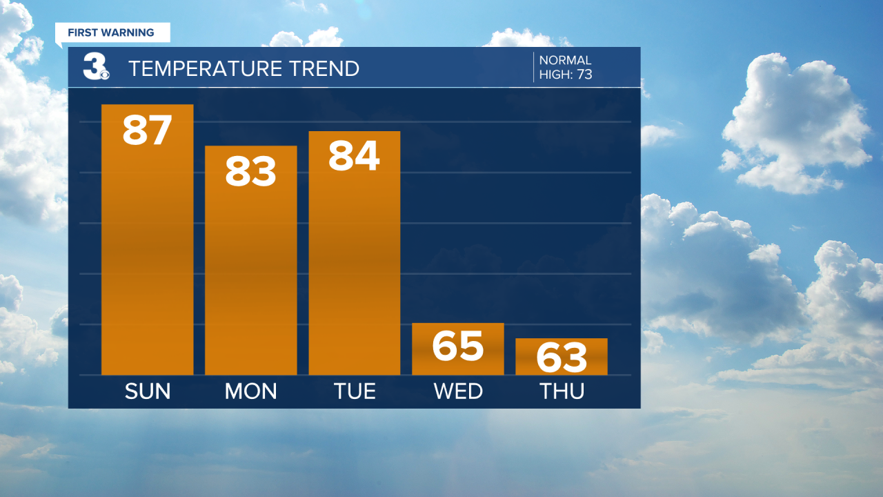
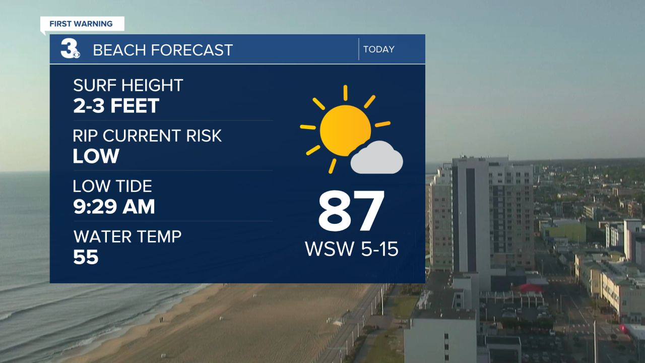
Get ready for the hottest day we've felt in quite some time. With high pressure anchored offshore and downsloping west winds, highs will soar to the mid and upper 80s today, about 15 degrees above normal for this time of year. It'll feel just like summer, and we will stay dry under mostly sunny skies. Might be a good day to head out to the beach!
Heading back to work Monday we'll have a few more clouds but it will still be warm and dry with highs in the low 80s. Our attention then shifts to our next cold front that is set to arrive Tuesday afternoon to early evening.
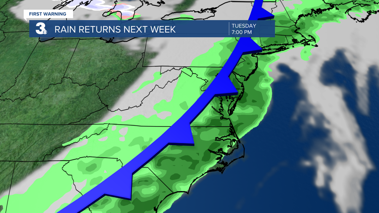
Tuesday will be another warm day with highs in the mid 80s. Showers and storms will increase in coverage directly behind the front and become widespread especially Tuesday night. At this time severe weather does not look likely but as with any storms, heavy rain and gusty winds will be possible.
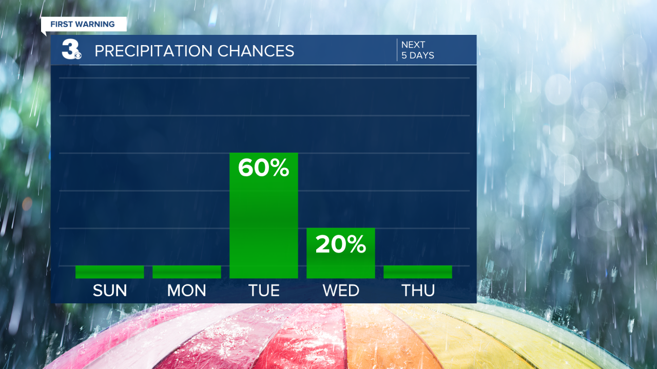
Temperatures will take a nosedive to end the week behind Tuesday's cold front. Highs Wednesday will only be in the mid 60s, and on Thursday, highs will be in the low 60s. Both Wednesday night and Thursday night will have lows in the 40s, but isolated 30s will be possible inland both nights. Wednesday will feature a few showers to start with decreasing clouds and sunshine to close out the day. Despite cooler highs we'll still get to enjoy a lot of sunshine Thursday and Friday before rain chances increase by the upcoming weekend.