

Meteorologist Tony Nargi's First Warning Forecast
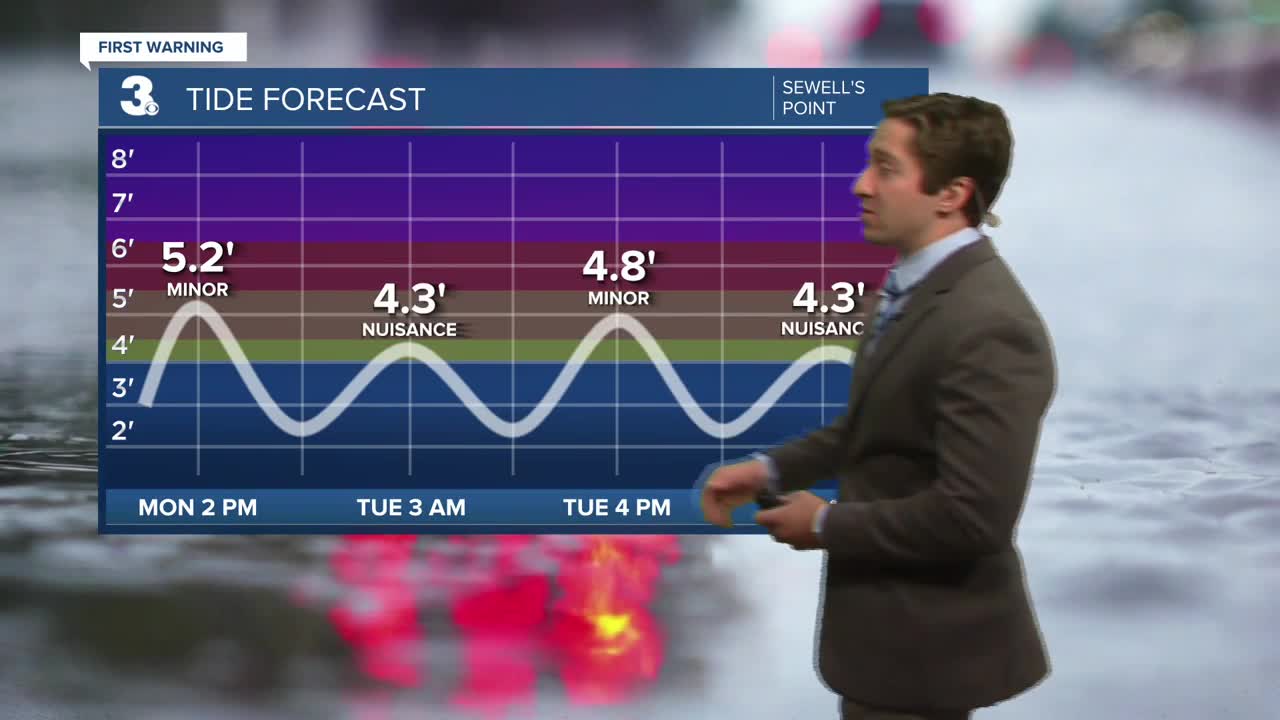
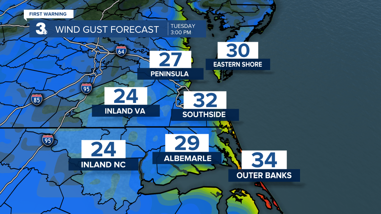
Today we're expected to see some improvement in the forecast, with less tidal flooding along with little rain and lighter winds. Highs will reach the mid to upper 60s with winds out of the N at 10-20 mph, gusting to 30 mph. Lingering showers and drizzle are expected throughout the day, with minimal rainfall accumulations expected. Minor to moderate tidal flooding is expected during the afternoon high tide. Tonight temperatures will drop into the 50s with cloudy skies remaining.


Tomorrow will be mostly cloudy with spotty showers possible in the morning. It will still be breezy ,with winds out of the N at 10-20 mph gusting to 30 mph at times. Highs will reach the mid to upper 60s. Some nuisance to minor tidal flooding is possible during the afternoon. Overnight Tuesday some clearing is expected. Wednesday will be mainly dry along with mostly sunny skies. It will be breezy again, with winds out of the N at 10-15 mph, gusting to 25 mph. Some nuisance tidal flooding is possible again as the tidal flooding slowly tapers down this week. Overnight Wednesday a cold front will move through, dropping temperatures down to end the week.

The end of this week looks great, with mainly sunny skies expected along with cool conditions in the 60s along with plenty of sunshine. Our next chance of rain looks to be Sunday/Monday of next week.

Weather updates on social media:
