

Meteorologist Maddie Kirker's First Warning Forecast:
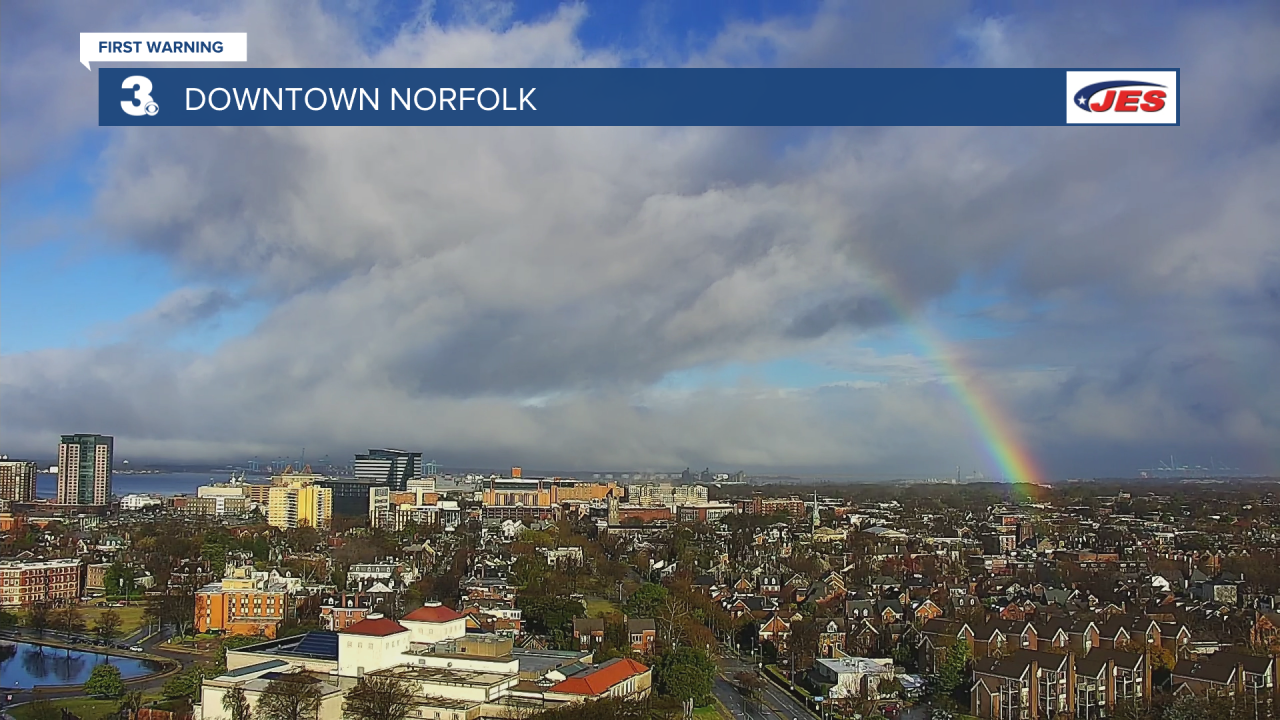
Did you catch this mornings rainbow? If not, here's a snapshot of around 9am this morning from our tower camera in downtown Norfolk.
Our luck will certainly go up the rest of the day. After a soggy start, the St. Patrick's Day showers will taper off throughout the rest of the afternoon as low pressure pulls away from the coast. Most of the area will be dry by 5pm expect for the Eastern Shore which may have a lingering shower.

Highs today will be in the mid and upper 60s but Friday will be even warmer. Temperatures Friday will warm to the low to mid 70s, which is 15 degrees above normal for this time of year. Most of the day will be dry but showers could sneak in Friday night ahead of our next cold front.
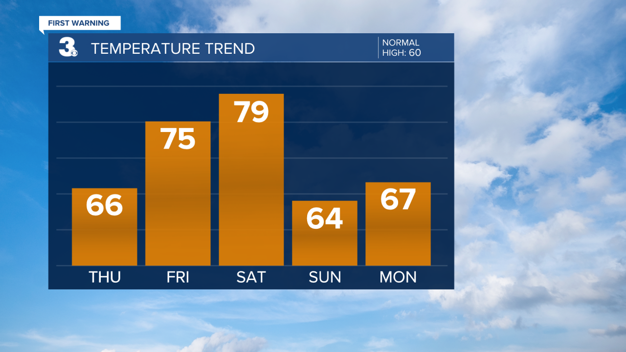
Expect widely scattered showers Saturday (mainly in the morning) as the cold front moves through. Winds will kick up Saturday, SW at 10 to 20 mph. Temperatures will drop behind the cold front from near 80 on Saturday to the mid 60s on Sunday. Sunshine will return for Sunday and winds will back down.
