


Meteorologist Myles Henderson’s First Warning Forecast
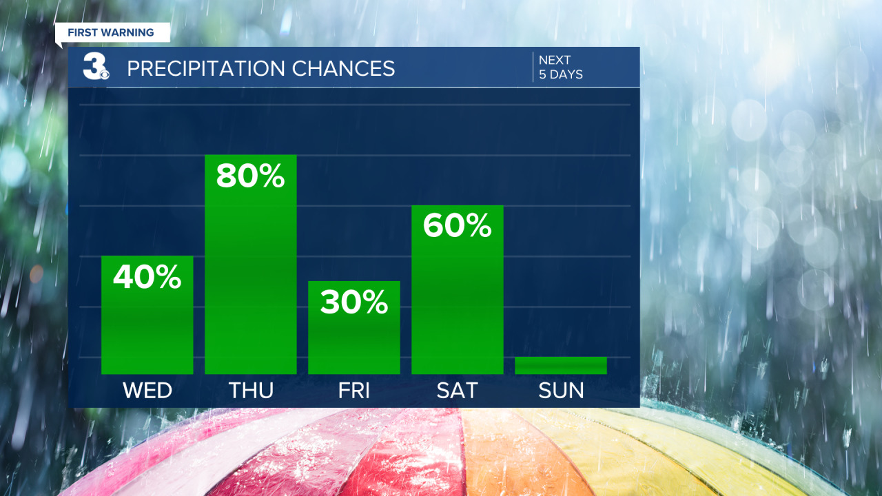
Tracking rain and storms for Saint Patrick’s Day, plus another rain chance to start the weekend. Our stretch of warmer days continues with highs in the 60s and 70s.
It will be warm again today with highs in the upper 60s. Expect a mix of clouds, partly to mostly cloudy. Rain chances will be slim during the day, but showers will build in from south to north tonight.
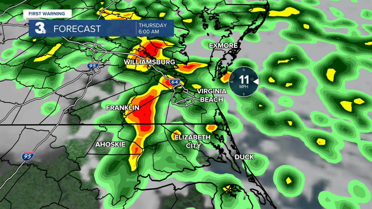
Showers and storms will move through Thursday as an area of low pressure tracks up the Carolina coast. Our biggest chance for rain will be Thursday morning with strong to severe thunderstorms possible. Expect highs in the mid 60s tomorrow with some clearing in the afternoon.
We will warm to the low 70s on Friday with a nice mix of sun and clouds. Most of the day will be dry but showers could sneak in Friday night ahead of a cold front.
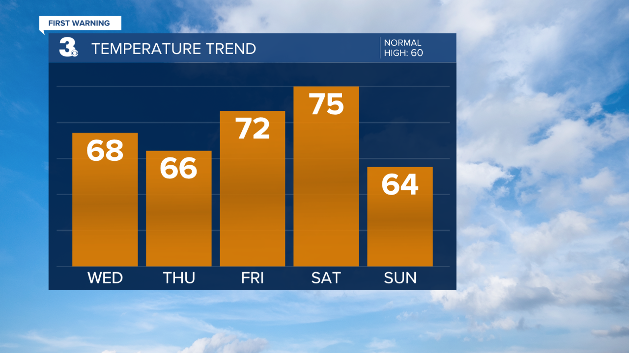
Expect scattered showers Saturday (mainly in the morning) as the cold front moves through. Winds will kick up Saturday, SW at 10 to 20 mph. Temperatures will drop behind the cold front from the mid 70s on Saturday to the mid 60s on Sunday. Sunshine will return for Sunday and winds will back down.
Today: Partly to Mostly Cloudy. Highs in the upper 60s. Winds: SW/SE 5-10
Tonight: Showers Building In. Lows in the mid 50s. Winds: SE/E 5-10
Tomorrow: AM Storms, PM Clearing. Highs in the mid 60s. Winds: E/S/W 5-10
Weather & Health
Pollen: High (Juniper, Maple, Ash)
UV Index: 5 (Moderate)
Air Quality: Good (Code Green)
Mosquitoes: Low
Weather updates on social media:
Facebook: MylesHendersonWTKR
Twitter: @MHendersonWTKR
Instagram: @MylesHendersonWTKR
