

Meteorologist Tony Nargi's First Warning Forecast
Tonight, it won't be quite as cold as the last couple of nights, with evening temperatures dropping into the upper 30s and overnight lows right around the 30-degree mark. We'll see clear skies tonight with winds picking up out of the SW to about 10 mph by sunrise.

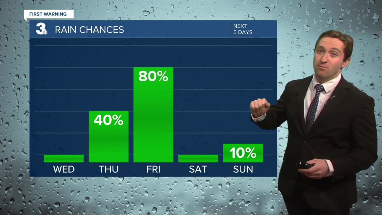
Tomorrow will be mostly sunny to start with increasing clouds during the morning. By the afternoon we'll see mostly cloudy skies with high temperatures near normal in the mid 50s. It will be a bit breezy, with winds out of the SW at 10-20 mph. Overnight lows will be near normal, staying above freezing in the mid to upper 30s.

On Thursday we'll see mostly cloudy skies during the morning followed by showers developing during the afternoon. High temperatures will be mild, getting into the upper 50s to low 60s. Winds will be out of the S at 10-15 mph. Overnight showers will turn to a steady rain, with some isolated downpours and thunderstorms possible as well. Rain will continue into early Friday morning, with rain tapering off by midday Friday. We'll see between 0.5" and 1.5" of rain. Highs on Friday will occur in the morning, with temperatures in the upper 50s dropping down to the 40s by the afternoon. Winds will start off light, then pick up out of the WNW at 15-20 mph, gusting up to 30 mph.

This weekend looks pleasant, with sunshine and highs in the upper 40s expected on Saturday followed by 50s and partly cloudy skies on Sunday!

Weather updates on social media:
