


Meteorologist Myles Henderson’s First Warning Forecast
A warm end to the week with highs in the 70s. Tracking showers to start the weekend. Cooler air returns next week.
Get ready for an odd temperature trend today. We will warm to the mid 70s by midday with SW winds. Winds will shift to the NE in the afternoon, driving in cooler air. Temperatures will fall into the 60s and even 50s, especially for our northern locations. We will see partly cloudy skies with isolated showers possible, mainly on the Peninsulas and Eastern Shore.

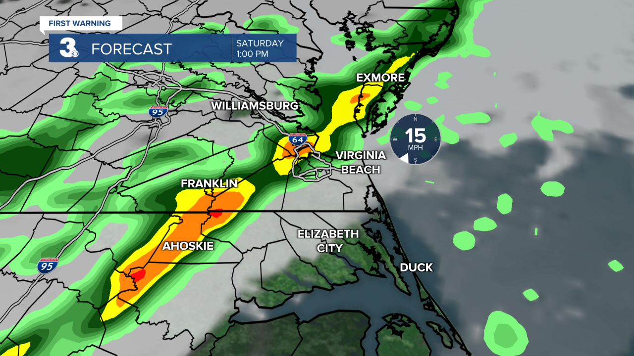
Highs will warm to the upper 70s on Saturday with strong SW winds. Expect partly to mostly cloudy skies with scattered showers, mainly in the afternoon.
Sunday will be the pick of the weekend with mostly sunny skies, highs in the low 70s, and light winds.
Cooler air will settle in for next week with highs in the low 60s and upper 50s, near or just below normal for this time of year. Scattered showers will return to the forecast for Monday and Tuesday.

Today: Partly Cloudy, Breezy. Highs in the mid 70s. Winds: SW/NE 10-15
Tonight: Partly Cloudy, Isolated Showers. Lows near 50. Winds: NE 10-15
Tomorrow: Mix of Clouds, Scattered Showers. Highs in the upper 70s. Winds: S 10-20G30
Weather & Health
Pollen: High (Juniper, Elm, Poplar)
UV Index: 6 (High)
Air Quality: Moderate (Code Yellow)
Mosquitoes: Low
Weather updates on social media:
Facebook: MylesHendersonWTKR
Twitter: @MHendersonWTKR
Instagram: @MylesHendersonWTKR
