First Warning Forecast:
Tracking yet another strong storm system on a Thursday giving us the threat of severe weather... Clouds will be on the increase overnight with lows in the upper 50s.
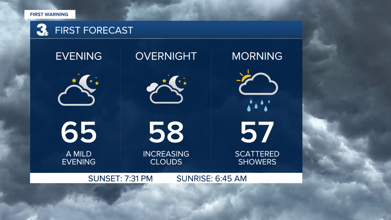
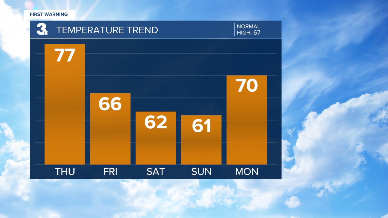
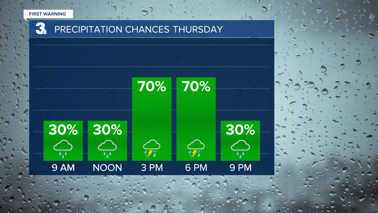
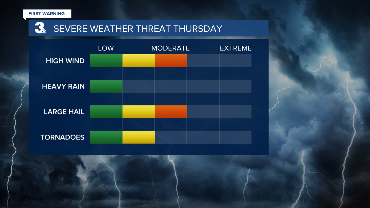
We'll start our Thursday cloudy and mild with the chance of scattered showers. Highs will return to the mid 70s again tomorrow. The strong cold front is set to move in during the afternoon to evening (2 PM to 7 PM). Strong to severe thunderstorms are possible with the potential for damaging wind gusts, hail, and isolated tornadoes.


Cooler air will return for Friday and the weekend. Expect partly cloudy skies with a few lingering showers (20% chance) Friday. Highs will drop to the mid 60s, near normal for this time of year. We will see partly cloudy skies on Saturday and mostly sunny skies on Sunday with highs in the low 60s both days.