Meteorologist Maddie Kirker's First Warning Forecast:
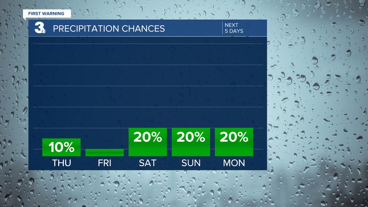
After a spring tease, it's back to winter to end the work week.. A cold front is currently and will continue to move south through the area this afternoon. This will lead falling temperatures as the wind shifts to northeast behind the front. The 60s and 70s we felt this morning will fall to the 50s and 40s late this afternoon to early evening. Expect a mix of clouds today, but dry air close to the surface will keep our rain chance at 10%.
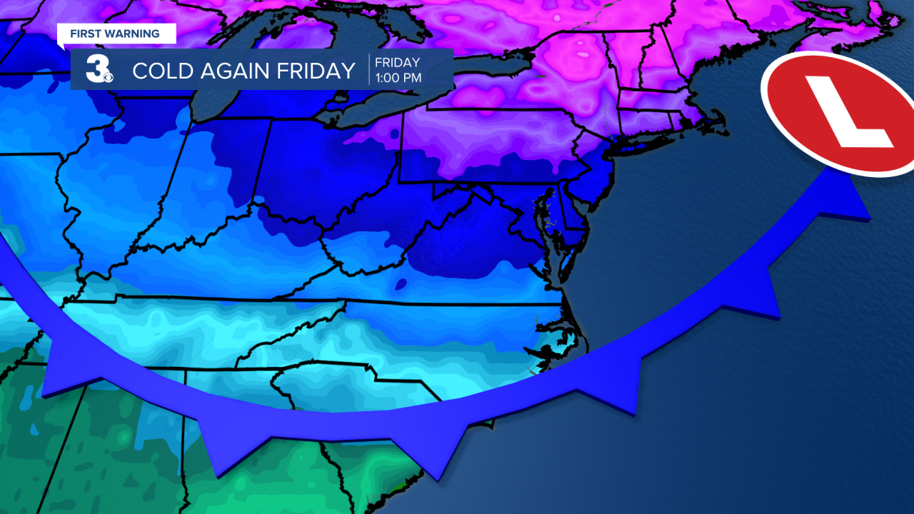
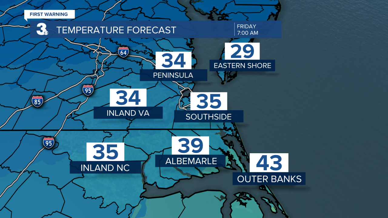
The coldest day of the week will be Friday as the cold air from the front sets in. We'll start the day in the low to mid 30s and highs will only reach the mid and upper 40s, some 10 degrees below normal for this time of year. Skies will be partly cloudy.
Thankfully this cold air will only "stick" for 24 hours. We will warm back to the 60s and 70s this weekend as a warm front lifts through from south to north. The front will bring in a mix of sun and clouds and the chance for a few spotty showers. It will be warm and windy on Monday with highs near 80, 25 degrees above normal for this time of year. A cold front will bring in a bigger rain chance and another temperature drop on Tuesday.