

Derrah Getter's First Warning Forecast
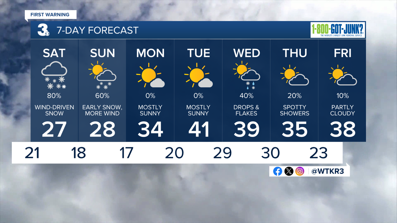
The below freezing temperature trend continues Friday. Snow showers arrive on Saturday.
More clouds build in this evening. We hang onto the dry conditions for now. Snow showers build in from south to north Saturday morning.

Snow starts first for portions of the Outer Banks. Northeast North Carolina is where we’re expecting some of the highest totals. 8-10'’ of snow will be possible, but some spots could see isolated amounts of up to 12’’.
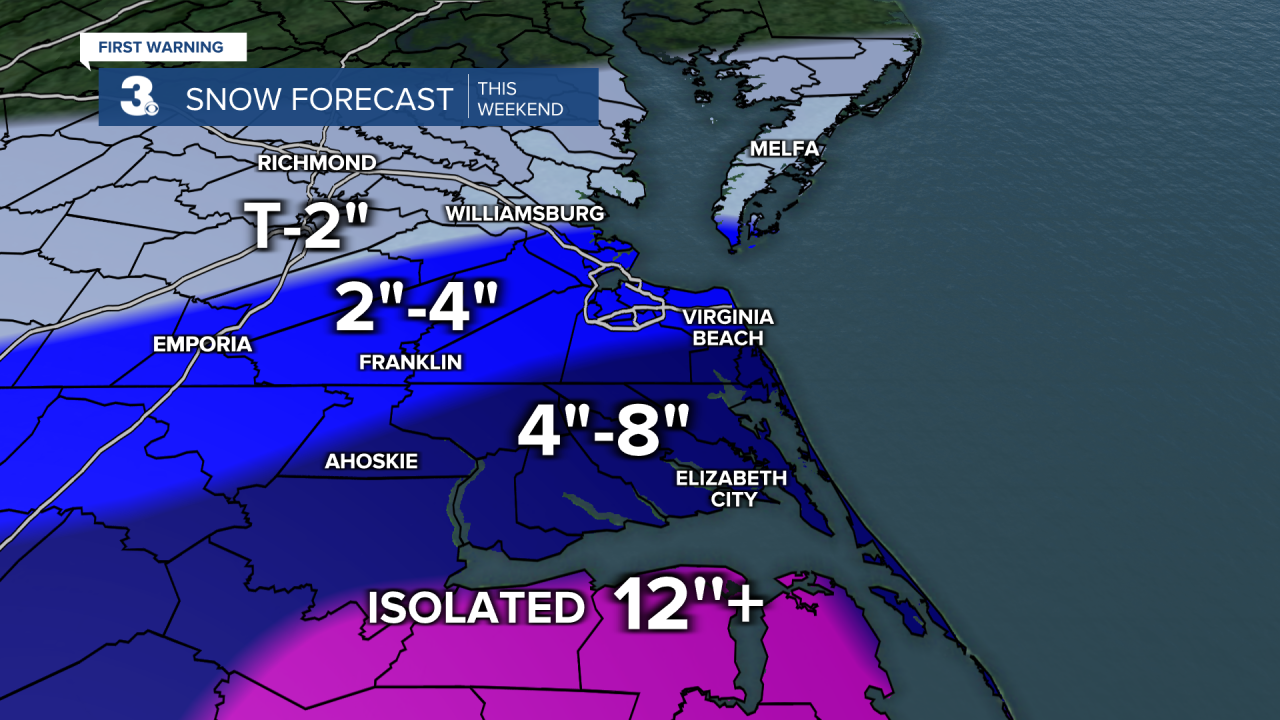
The snow will spread from south to north throughout the afternoon and evening on Saturday. Snow begins later in the day for Hampton Roads. Anywhere from 4-6'’ is expected. Snowfall amounts get lower the farther north you go. Areas like Williamsburg, Gloucester, James City Co., and Yorktown can expect 1-3'’.

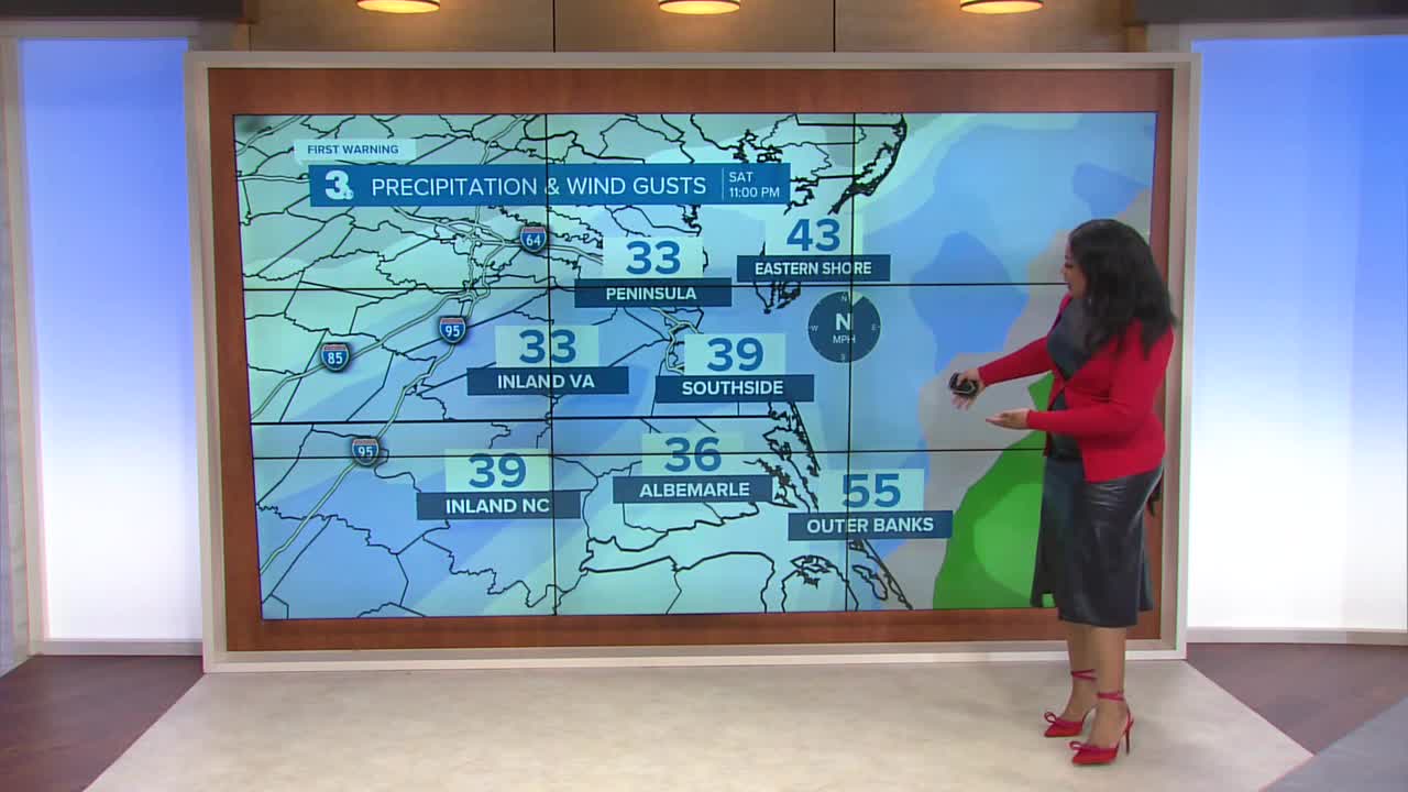
There will be a very distinct snowfall cutoff which will skew some of the totals to the southeast and lower totals to the northwest. Either way, snow won’t be our only issue. There will be wind gusts of up to 45-60 mph. Highest winds will be along the Outer Banks. The wind will blow the snow around making it not only harder to accurately measure but cause visibility issues. Wind chill values dip below 0 degrees Sunday morning.

Tidal and coastal flooding will be a concern with the worst of the water levels expected on Sunday morning. This will reintroduce moisture to an already frozen ground and impact travel.
We finally thaw out next week and break our sub-freezing streak. Temperatures make a run for 40, which will help with any melting.
Let's connect on social media!
Forecaster Derrah Getter:
For weather updates on Facebook: HERE
For weather updates on X: HERE
Follow me on Instagram: HERE
Check out the Interactive Radar on WTKR.com: Interactive Radar
