


Derrah Getter's First Warning Forecast
This evening, clouds build in. Lows will be in the upper 30s and low 40s.
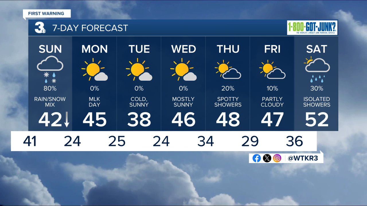
Sunday will be gloomy and wet. Overcast skies and widespread rain linger throughout most of the day. Temperatures fall during the afternoon giving way to a mix of rain and snow and eventually all snow for some of our inland spots.

Skies clear out just in time for Martin Luther King Jr. Day! Highs will be in the low to mid 40s with plenty of sunshine.
Tuesday will be our coolest day yet so far this winter season. Highs are forecast to only reach the mid to upper 30s.
We have some cool nights ahead with lows in the 20s and sunny days with highs in the 40s. Precipitation chances return at the end of the week and linger into the start of the upcoming weekend.
Let's connect on social media!
Forecaster Derrah Getter:
For weather updates on Facebook: HERE
For weather updates on X: HERE
Follow me on Instagram: HERE
Check out the Interactive Radar on WTKR.com: Interactive Radar
