


Meteorologist Myles Henderson’s First Warning Forecast
Tracking showers and storms this weekend. Building more heat and humidity next week. Several days with a heat index to 100+.
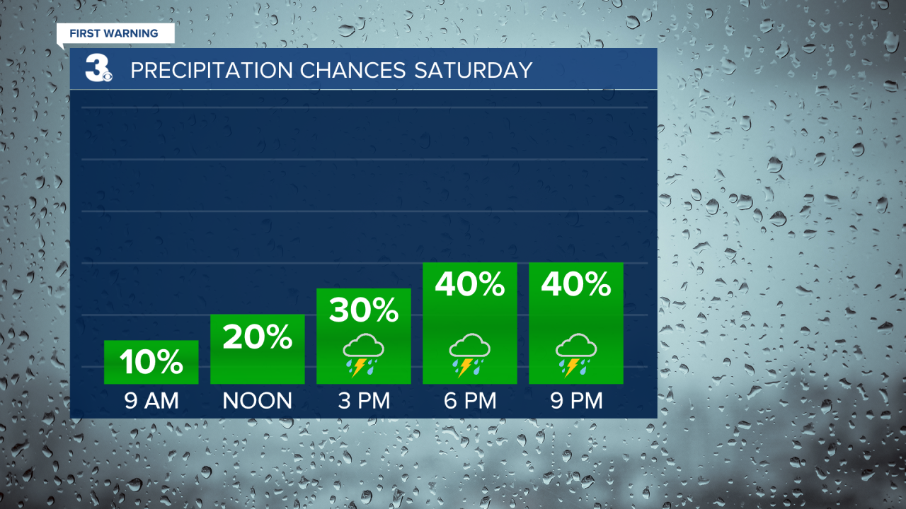
We will see some sunshine this morning, but scattered showers and storms will fire up again this afternoon to evening. Strong to severe storms are possible with damaging wind gusts, hail, and localized flooding. Highs will return to the mid 80s today, but it will still be muggy.
We will warm to near 90 on Sunday, just the first step in a very warm week ahead. We will see a mix of sun and clouds tomorrow with scattered showers and storms possible in the afternoon to evening.
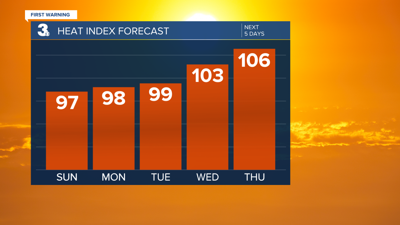
Get ready for an extremely hot and humid stretch next week. Highs will climb to the low and mid 90s with an afternoon heat index to 100+ by midweek. Scattered showers and storms are possible each day, but no day looks to be a total washout.
Today: Partly Cloudy, Scattered Showers/Storms. Highs in the mid 80s. Winds: S 5-10
Tonight: Partly Cloudy, Scattered Showers/Storms. Lows in the low 70s. Winds: S 5-10
Tomorrow: Partly Cloudy, Scattered Showers/Storms. Highs near 90. Winds: SW 5-10
Weather & Health
Pollen: Low-Medium (Grasses)
UV Index: 9 (Very High)
Air Quality: Good (Code Green)
Mosquitoes: Extreme
Tropical Update
No tropical activity at this time
Weather updates on social media:
Facebook: MylesHendersonWTKR
Twitter: @MHendersonWTKR
Instagram: @MylesHendersonWTKR
