

Derrah Getter's First Warning Forecast
Today’s rain is beginning to transition into snow.

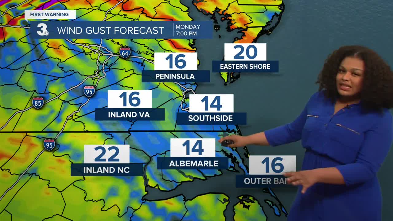
Widespread snowfall is expected to continue for most of the area through midnight. ESVA will see the highest snowfall totals with showers continuing through Monday morning. Winds ramp up overnight with gusts up to 40 mph. Winter weather alerts continue through Monday evening.

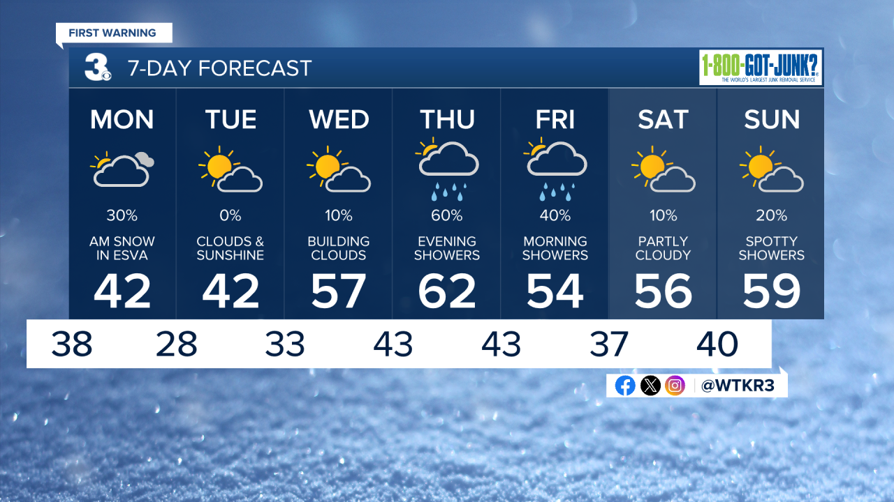
Monday will be mostly cloudy and cool. High temperatures will reach the low to mid 40s. Temperatures turn milder by the middle of the week with highs reaching the 60s by Thursday.
More rain showers arrive late Thursday and linger into Friday morning. Thankfully, the upcoming weekend looks mainly dry.
Let's connect on social media!
Forecaster Derrah Getter:
For weather updates on Facebook: HERE
For weather updates on X: HERE
Follow me on Instagram: HERE
Check out the Interactive Radar on WTKR.com: Interactive Radar
