


Meteorologist Myles Henderson’s First Warning Forecast
***Heat Advisory from 11 AM to 8 PM Thursday for the Peninsula, Middle Peninsula, parts of the Southside, and parts of Northeastern North Carolina.

A stretch of typical summer days with heat, humidity, and a chance for afternoon storms.
More heat and humidity today. Highs will climb to the mid 90s with an afternoon heat index to 105+. We will see mostly sunny to partly cloudy skies today with scattered showers and storms popping up this afternoon.
Keep it going for Friday with highs in the low to mid 90s and a heat index 100 to 105. We will see a mix of sun and clouds with scattered showers and storms firing up in the afternoon.
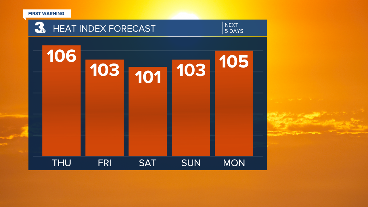
Highs will linger in the low to mid 90s this weekend with an afternoon heat index near 100. We will see mostly sunny to partly cloudy skies with a scattered shower or storm possible, mainly in the afternoons to evenings.
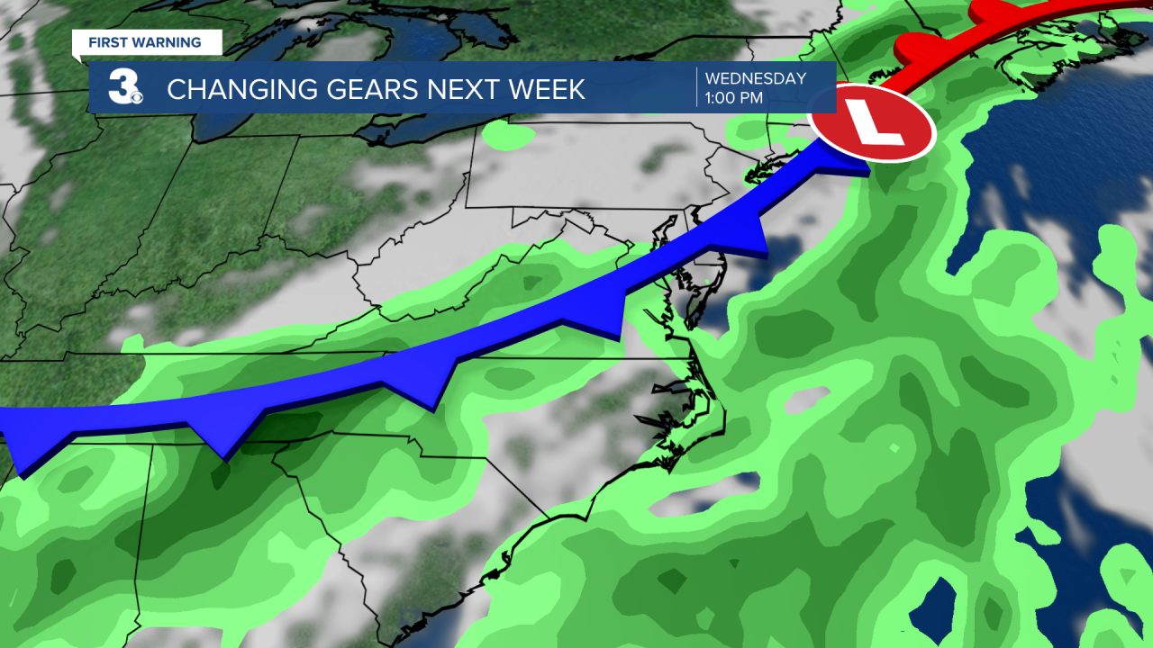
I am keeping my eye on a cold front set to move through the region by midweek. This front will bring us a bigger chance for rain but should also usher in cooler air for the end of next week.
Today: Partly Cloudy, Scattered Storms. Highs in the mid 90s. Winds: SW/S 5-10
Tonight: Partly Cloudy. Lows in the mid 70s. Winds: S 5-10
Tomorrow: Partly Cloudy, Scattered Storms. Highs in the low 90s. Winds: S 5-10
Weather & Health
Pollen: Medium (Grasses)
UV Index: 9 (Very High)
Air Quality: Good (Code Green)
Mosquitoes: Extreme
Tropical Update
No tropical activity at this time
Weather updates on social media:
Facebook: MylesHendersonWTKR
Twitter: @MHendersonWTKR
Instagram: @MylesHendersonWTKR
