


Meteorologist Myles Henderson’s First Warning Forecast
Lower humidity again today, mugginess returns next week. Tropical development along the Carolina coast.
Another nice day! Highs will reach the mid to upper 80s, near normal for this time of year. The humidity will remain low (for July). We will see a mix of mostly sunny to partly cloudy skies with a spotty shower/storm possible.

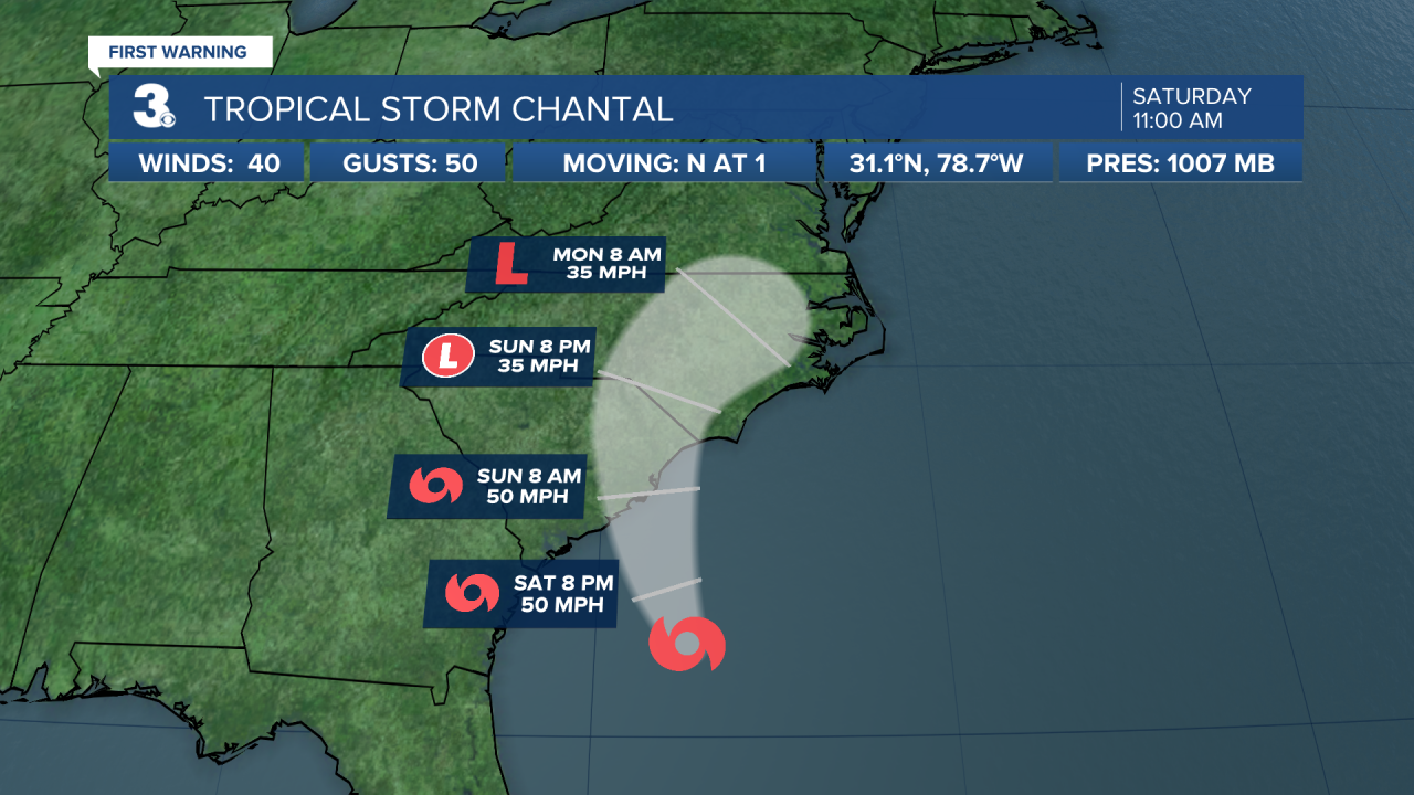
Highs will return to the upper 80s on Sunday, but the humidity will start to increase, making it feel more like the 90s. Expect a mix of clouds with scattered showers and storms as the outer rain bands from Tropical Storm Chantal spread across the Southeast to Mid-Atlantic.
Showers and storms from the remnants of Chantal will continue for Monday as the system falls apart over eastern North Carolina and Virginia.

Get ready for another humid and soggy stretch of days ahead. Highs will linger near 90 for most of next week with afternoon heat index values in the triple digits. Each day will have the chance for showers and storms as a front meets up with the tropical moisture and stalls out over the region.

Today: Sun & Clouds. Highs in the upper 80s. Winds: E 5-15
Tonight: Partly Cloudy. Lows in the mid 70s. Winds: SE 5-10
Tomorrow: Scattered Storms. Highs in the upper 80s. Winds: S 5-15
Weather & Health
Pollen: Medium (Grasses)
UV Index: 10 (Very High)
Air Quality: Moderate (Code Yellow)
Mosquitoes: Extreme
Tropical Update
Tropical Storm Chantal is centered about 135 miles SSE of Charleston, SC. On the forecast track, the center of Chantal is expected to move across the coast of South Carolina Sunday morning.
Maximum sustained winds are near 40 mph with higher gusts. Some strengthening is expected before Chantal reaches the coast.
Weather updates on social media:
Facebook: MylesHendersonWTKR
Instagram: @MylesHendersonWTKR
