

Meteorologist Tony Nargi's First Warning Forecast
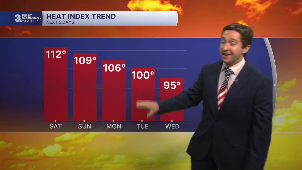
Today will be very hot for the 4th of July celebrations, with high temperatures reaching the upper 90s to low 100s and heat indices surpassing 110 degrees. This is dangerous heat, stay cool and be careful out there. An extreme heat warning is in effect until 8 PM. We'll see mostly sunny skies and hazy conditions for most of the day. This afternoon after 3 PM some isolated storms capable of producing severe wind gusts will be possible, particularly on the peninsulas. Winds will be light out of the SW at 5-10 mph. Overnight skies will clear out and lows will drop into the 70s.

Tomorrow will be very warm again, and another extreme heat warning is in effect. We'll see mostly sunny skies and high temperatures in the upper 90s to 100. Heat indices will be near 110. A stray afternoon thunderstorm will be possible on the peninsulas once again, though the chance of rain is only about 10-20% tomorrow. Winds will be light out of the WSW at 5-10 mph. Overnight lows will drop into the 70s with partly cloudy skies.

Temperatures will fall slightly on Monday thanks to some afternoon shower and storms that develop. We'll still see high temperatures in the mid 90s and heat indices in the mid 100s. Mostly sunny skies in the morning will transition to afternoon clouds and scattered showers and storms. Severe chances will be low, though an isolated storm could produce damaging wind gusts. Localized flooding is also likely where the heaviest storms develop. Tuesday will feature scattered showers and storms throughout the morning and early afternoon, with storms fading towards sunset. High temperatures will be slightly cooler, around 90 as temperatures slowly moderate next week.

By Wednesday we should start to dry out, and mainly dry conditions are expected by Thursday as temperatures cool off into the 80s.

Weather updates on social media:
