

Meteorologist Tony Nargi's First Warning Forecast
This evening a stray shower is possible along the Albemarle and Outer Banks, but mainly dry conditions are expected. We'll see temperatures in the 80s dropping into the 70s overnight. Winds will pick up out of the SW at 5-15 mph.

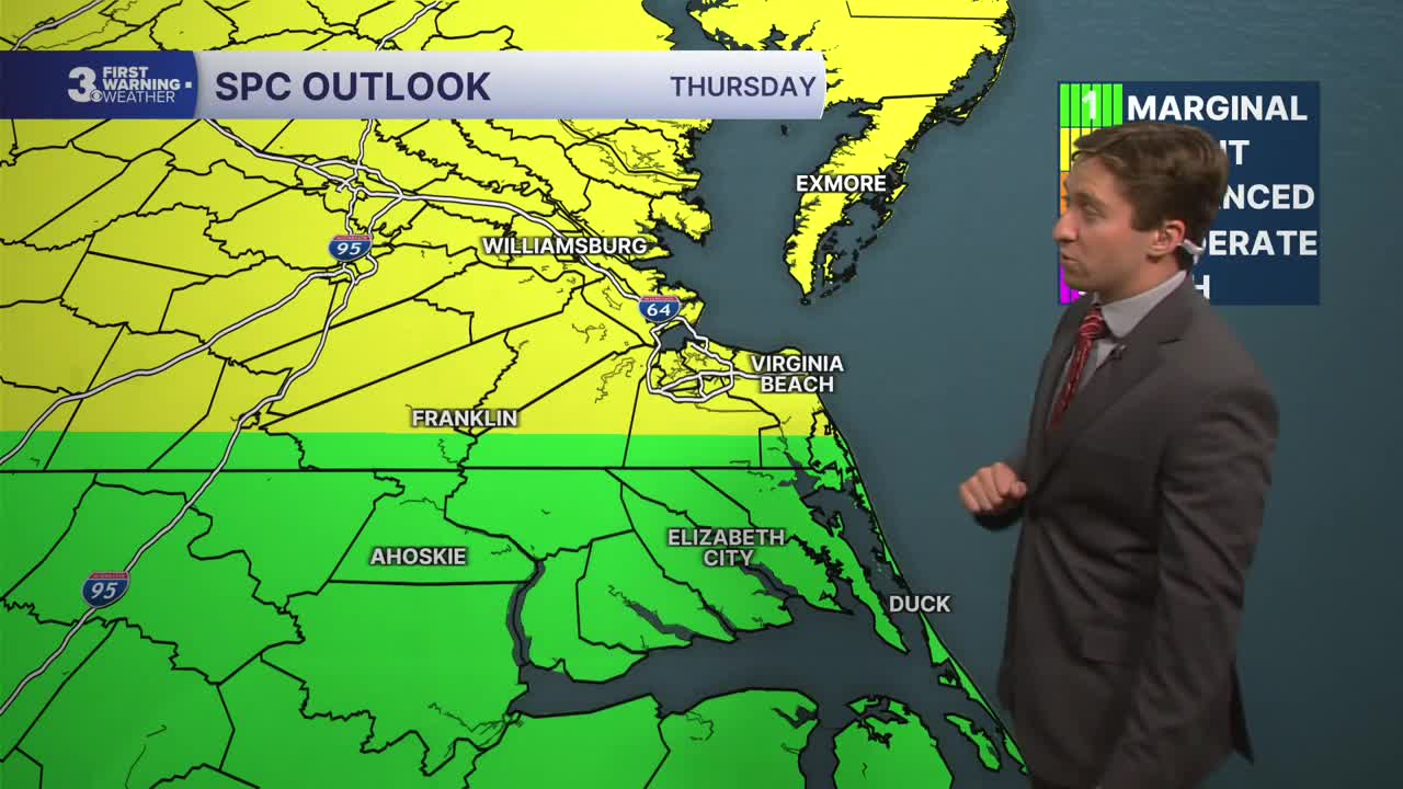
Tomorrow will be very hot, with high temperatures reaching the upper 90s to near 100, and heat indices reaching the mid 100s! We'll see mostly sunny skies in the morning followed by some clouds developing during the afternoon. It will be breezy, with wind south of the SW at 10-20 mph. There is a chance for some strong to severe storms tomorrow, particularly north of the NC/VA state line. The main threat for storms will be between 6 PM to 11 PM, with strong wind gusts up to 60 mph possible in the strongest cells.


Friday will be cloudy and wet to start, with on and off showers throughout the morning followed by some thunderstorms during the early afternoon. We'll see high temperatures in the mid 80s, with humid conditions persisting. It won't be raining the whole day, but if you plan on being outdoors for the Juneteenth and other celebrations, you'll need an umbrella or jacket handy. Showers and storms should clear out from west to east after 5 PM, with sunshine emerging to end the day of festivities!

Saturday is looking fantastic, with mostly sunny skies and highs in the mid 80s along with lower humidity. Sunday will be great for Father's Day as well, with high temperatures near 90 and partly cloudy skies along with dry conditions expected.

TROPICS:
Tropical Storm Arthur formed in the Atlantic today and has sustained winds of 45 mph as of 2 PM. It is slated to move inland quickly along the Gulf Coast and bring heavy rains and flash flooding to the Deep South. Tropical Storm Arthur is expected to quickly weaken as it moves inland, and impacts will stay mainly to our south. Though the Outer Banks will likely see higher rainfall totals on Friday thanks to that tropical moisture.

Weather updates on social media:
