


Meteorologist Myles Henderson’s First Warning Forecast
A warm and muggy midweek. Tracking two rounds of storms, today and Saturday. A cooler end to the week.
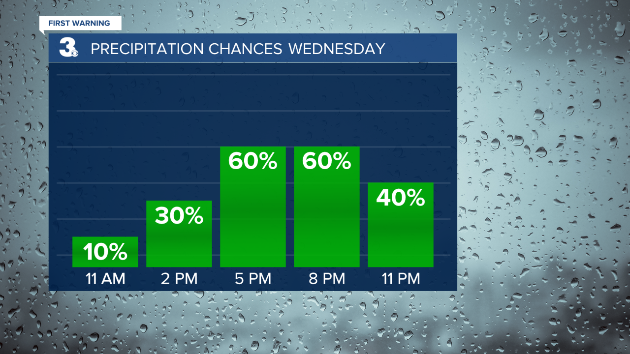
Highs will climb to the upper 80s today, but it will feel more like the low to mid 90s with the humidity. Expect a mix of partly to mostly cloudy skies today. Rain chances will be slim this morning to midday, but showers and storms will build in this afternoon. The biggest storm chance will be between 5 PM and 9 PM. Strong to severe storms are possible with damaging wind gusts and localized flooding.
Showers will linger for Thursday, mainly in the morning to midday. A stray storm is possible. Expect cloudy skies in the morning with clearing skies through the afternoon. It will still be warm and muggy on Thursday with highs in the mid to upper 80s.
Friday will look and feel nicer with highs in the low to mid 80s plus lower humidity. Rain chances will be slim with a mix of sun and clouds.
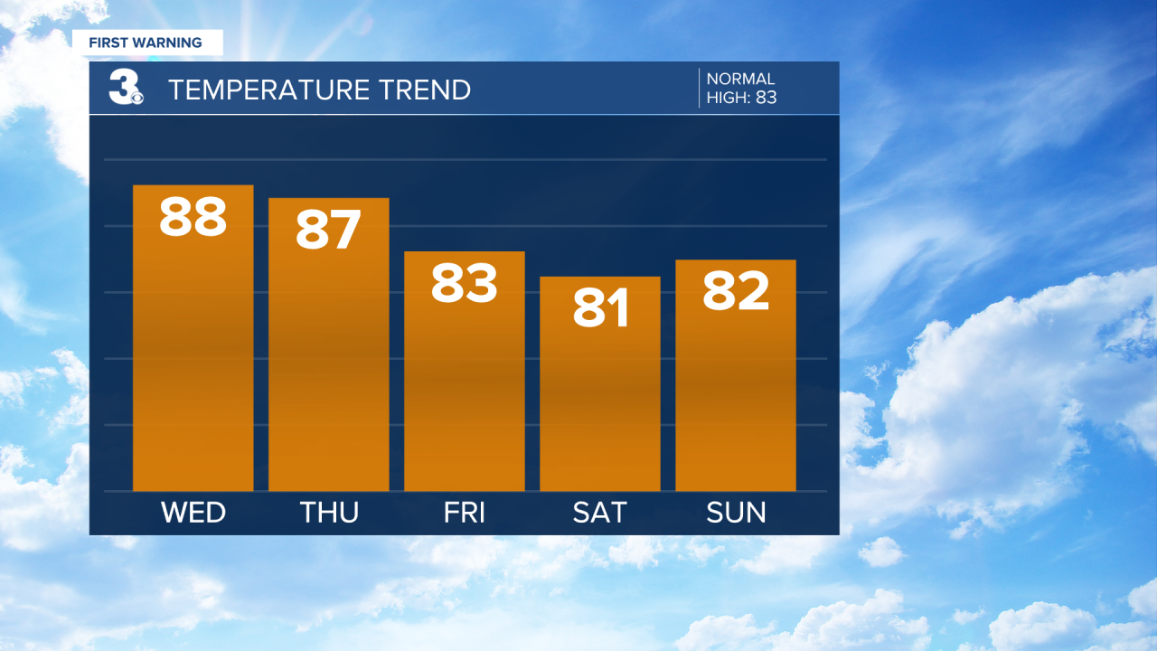
It is looking like a 50/50 weekend. Showers and storms will return for Saturday as a cold front moves through the region. Expect more sunshine on Sunday with lower rain chances. Highs will linger in the low 80s this weekend.
Today: Mix of Clouds, PM Storms. Highs in the upper 80s. Winds: S 5-10
Tonight: Mostly Cloudy, Showers/Storms. Lows in the low 70s. Winds: SW 5-15
Tomorrow: Showers, Clearing Skies. Highs in the upper 80s. Winds: SW/NW 10-15
Weather & Health
Pollen: Low-Medium (Grasses, Oak)
UV Index: 9 (Very High)
Air Quality: Good (Code Green)
Mosquitoes: Very High
Tropical Update
No tropical activity at this time
Weather updates on social media:
Facebook: MylesHendersonWTKR
Twitter: @MHendersonWTKR
Instagram: @MylesHendersonWTKR
