


Meteorologist Myles Henderson’s First Warning Forecast
Very warm and windy again today. Much cooler with several rain chances for the rest of the week.
Temperatures will climb to near 80 degrees again today, 20+ degrees above normal for this time of year. It will be very windy again today, SW at 15 to 25 mph with wind gusts at 30 to 40 mph. Expect partly cloudy skies today with slim rain chances. Showers will move in tonight with a cold front. Showers will build in after 8 PM from west to east.

Showers will move out early Tuesday morning (mainly before 6 AM) with partly cloudy skies for the rest of the day. It will be much cooler behind the cold front. Highs will only reach the low 50s tomorrow, below normal for this time of year. Winds will relax through the day as they turn from north to east.

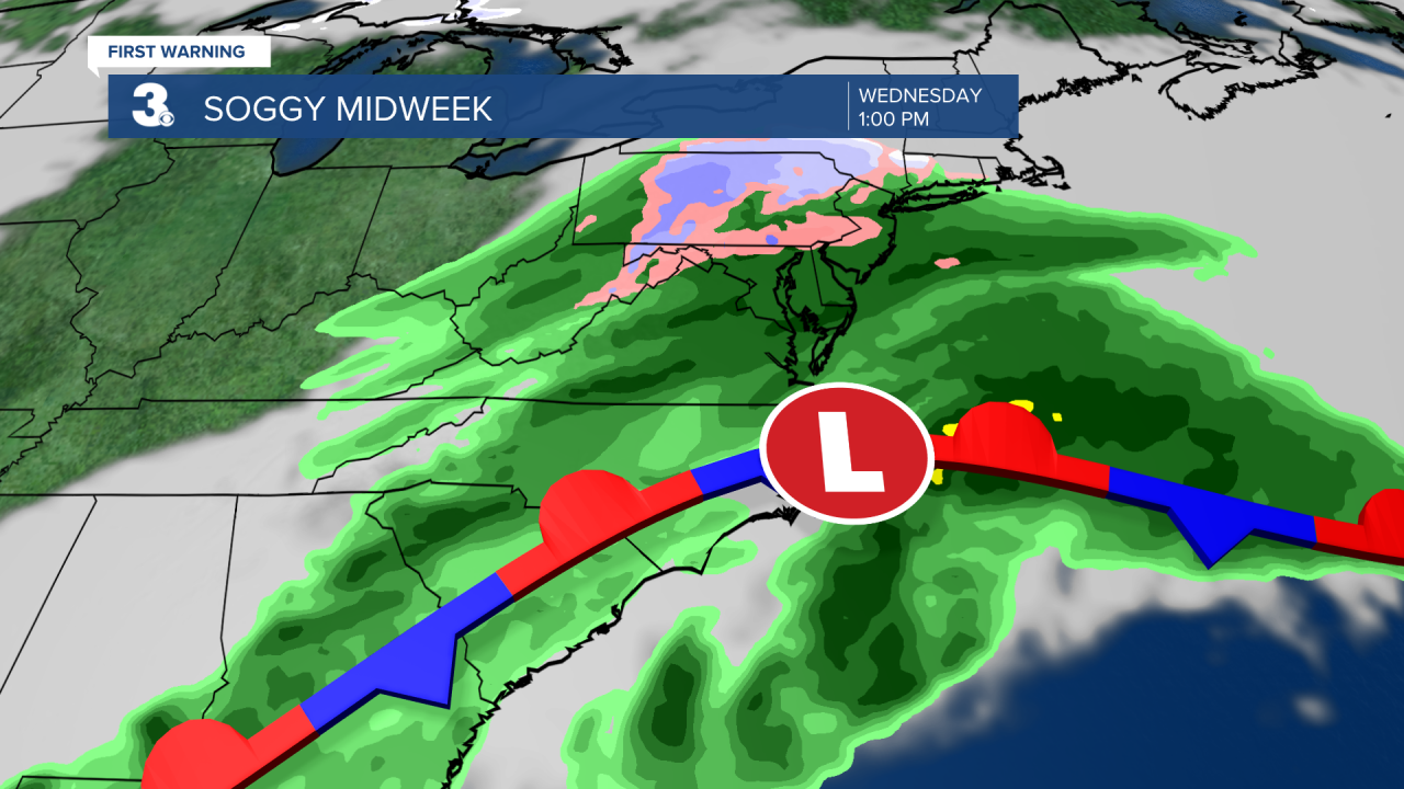
Wednesday will be the soggy day of the week as a stationary front and area of low pressure linger along the coast. Expect cloudy skies with widespread rain most of the day. Scattered showers will continue for Thursday, mainly in North Carolina.
We are tracking another cold front that will bring us rain Friday night to Saturday morning. We will see temperatures drop from the 60s to the 40s behind the front.
Today: Partly Cloudy, Windy. Highs in the low 80s. Winds: SW 15-25 G30+
Tonight: Partly to Mostly Cloudy, Showers. Lows in the upper 40s. Winds: W 10-20
Tomorrow: AM Showers, Partly Cloudy. Highs in the low 50s. Winds: N/E 5-15
Weather & Health
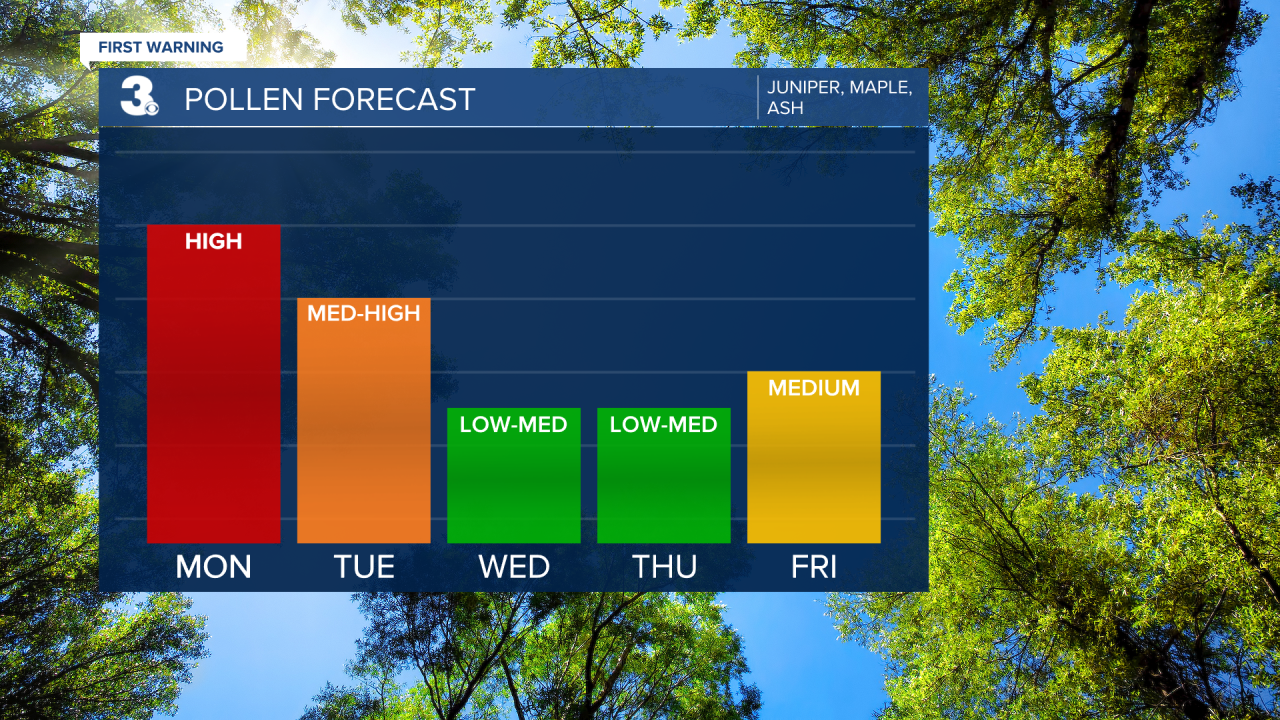
Pollen: High (Juniper, Maple, Ash)
UV Index: 6 (High)
Air Quality: Good (Code Green
Mosquitoes: Low-Moderate
Weather updates on social media:
Facebook: MylesHendersonWTKR
Twitter: @MHendersonWTKR
Instagram: @MylesHendersonWTKR
