

Derrah Getter's First Warning Forecast
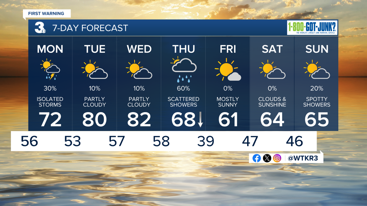
Isolated storms roll through the area this evening. Some stronger storms could produce damaging wind gusts and hail. The rain moves out overnight. Lows fall into the mid 50s.
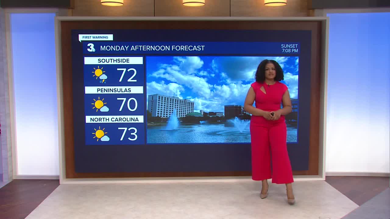
Patchy fog will be possible on Monday morning. Skies clear by the afternoon. A few spotty storms will be possible, but most of us will stay dry and sunny throughout the remainder of the day. Highs will reach the mid 70s.

Temperatures get even warmer through the middle of the week with highs pushing 80 degrees. We will be flirting with our record high temperature of 82 degrees on Wednesday.

Another cold front will bring widespread rain on Thursday and cooler temperatures for the rest of the week.
Let's connect on social media!
Forecaster Derrah Getter:
For weather updates on Facebook: HERE
For weather updates on X: HERE
Follow me on Instagram: HERE
Check out the Interactive Radar on WTKR.com: Interactive Radar
