


First Warning Forecast:
If you found yourself wondering where the warm weather was this weekend, think no more. High pressure and it's southwest wind will make us even warmer tomorrow, with highs in the low 80s. We'll start our Tuesday mostly cloudy with a stray shower, but clouds will decrease during the afternoon making for a 10/10 day. It'll be even warmer Wednesday with highs in the low to mid 80s.
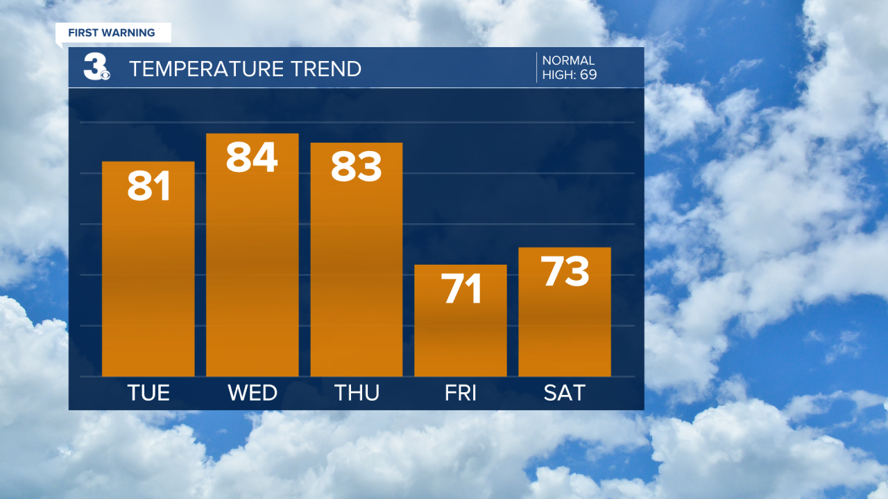
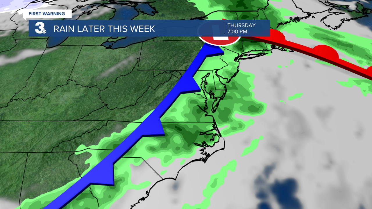
Our next rain chance moves in with a cold front on Thursday. Expect mostly cloudy skies with scattered showers, mainly Thursday afternoon to evening. An isolated thunderstorm is possible. Highs will return to the low 80s on Thursday but drop to the low 70s on Friday (behind the cold front). Look for clearing skies to finish up the work week.
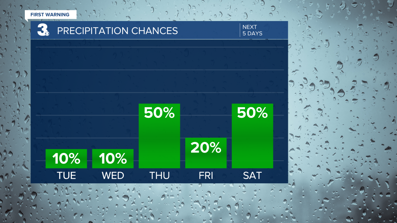
Highs will linger in the upper 60s to low 70s for Easter weekend, near normal for this time of year. Expect more clouds with a chance for rain on Saturday. Sunshine should return on Easter Sunday with highs near normal in the upper 60s.

