


Meteorologist Myles Henderson’s First Warning Forecast
Warmer today, two snow chances on the way… Today will be the warmest day of the week. Highs will reach the mid 50s, about 10 degrees warmer than yesterday. Expect partly cloudy skies with a SW wind at 10 to 15 mph.
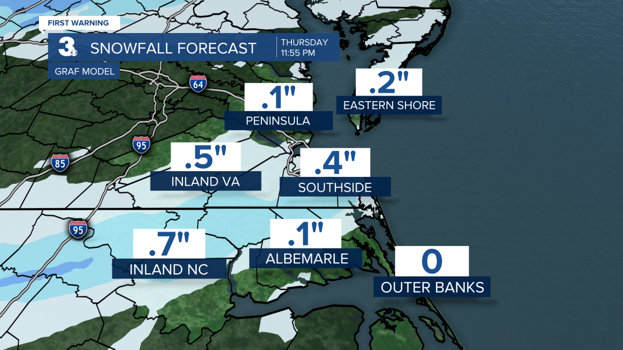
Rain will move in with a cold front Thursday morning but will change over to snow (from NW to SE) in the afternoon to evening as temperatures fall from the 40s to 30s. Some minor snow accumulation is possible by Thursday night (0” to 1”). Wind will kick up tomorrow, W/N at 10 to 20 mph
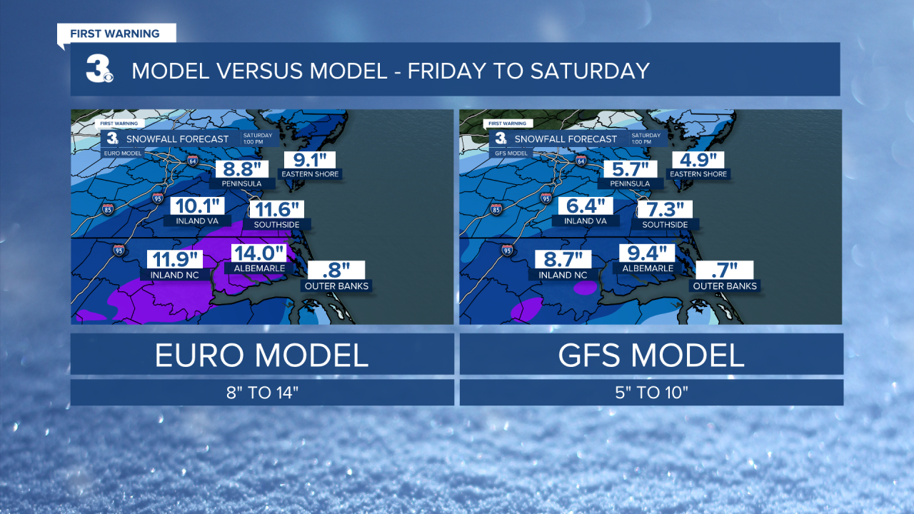
A bigger chance for snow is expected Friday and Saturday as an area of low pressure slides up the coast. Most of the area will see snow with rain for the Outer Banks. The biggest chances will be Friday PM to Saturday AM. Significant snow accumulation is possible (5” to 10”). Highs will only reach the low 30s on Friday and mid 30s on Saturday. It will be windy with north winds at 10 to 20 and gusts to 30 mph.
Today: Partly Cloudy, Warmer, Breezy. Highs in the mid 50s. Winds: SW 10-15
Tonight: Partly to Mostly Cloudy. Lows in the mid 40s. Winds: SW 5-10
Tomorrow: AM Rain, PM Snow, Windy. Highs in the upper 40s. Winds: W/N 10-20
Weather updates on social media:
Facebook: MylesHendersonWTKR
Twitter: @MHendersonWTKR
Instagram: @MylesHendersonWTKR
