


Meteorologist Myles Henderson’s First Warning Forecast
Sunny but cool to start the work week. Warming back to the 70s with rain and storm chances through midweek. Cooling to the 60s again this weekend.
A nice but cooler start to the week. We will see lots of sunshine this morning with clouds building in this afternoon. Highs will reach the low 60s, a few degrees below normal for this time of year.
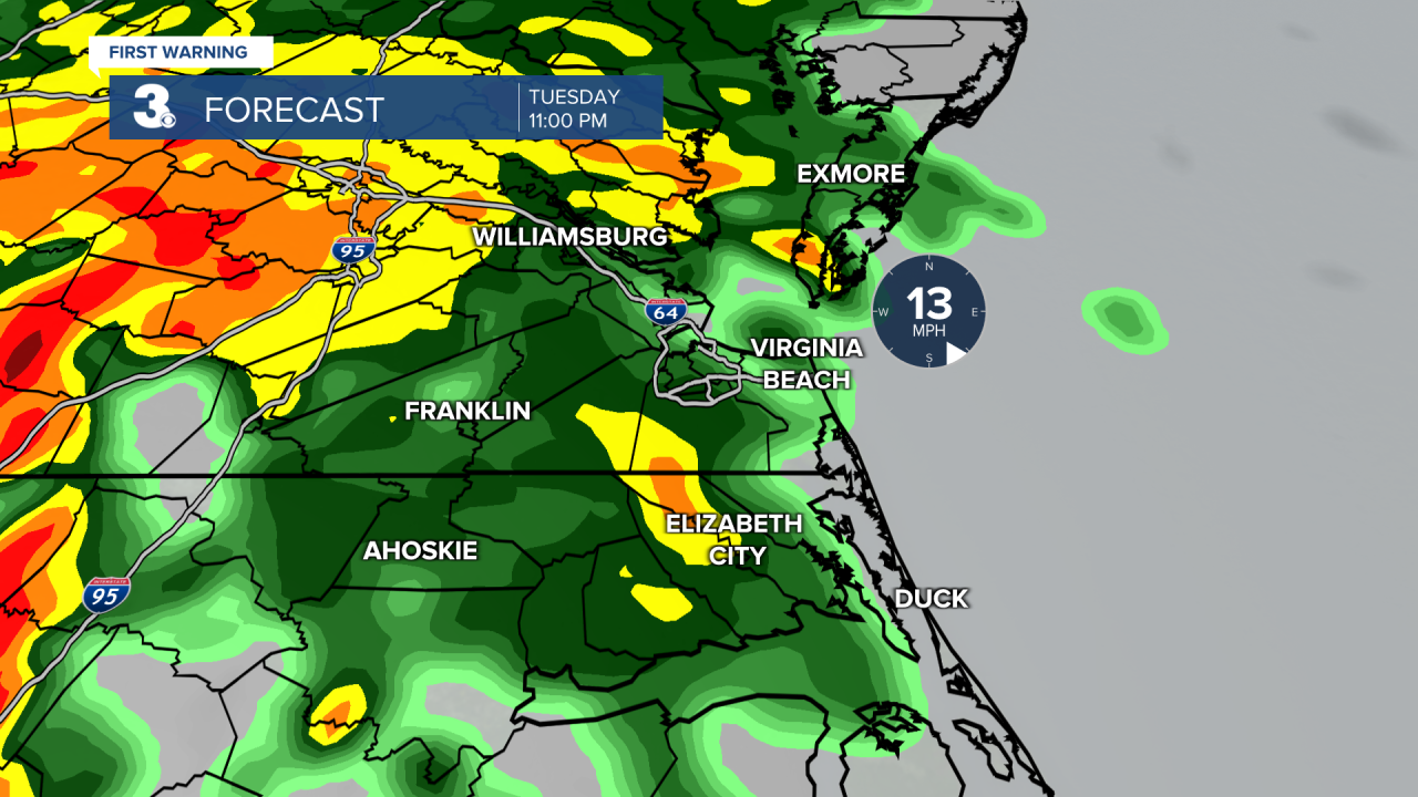
Warmer air returns tomorrow with highs in the mid 70s. Expect partly cloudy skies tomorrow with rain moving in late. A few showers are possible during the day, but the biggest chance will be Tuesday night to early Wednesday morning (10 PM to 5 AM). Showers will move out by midday Wednesday and sunshine will return by the afternoon.
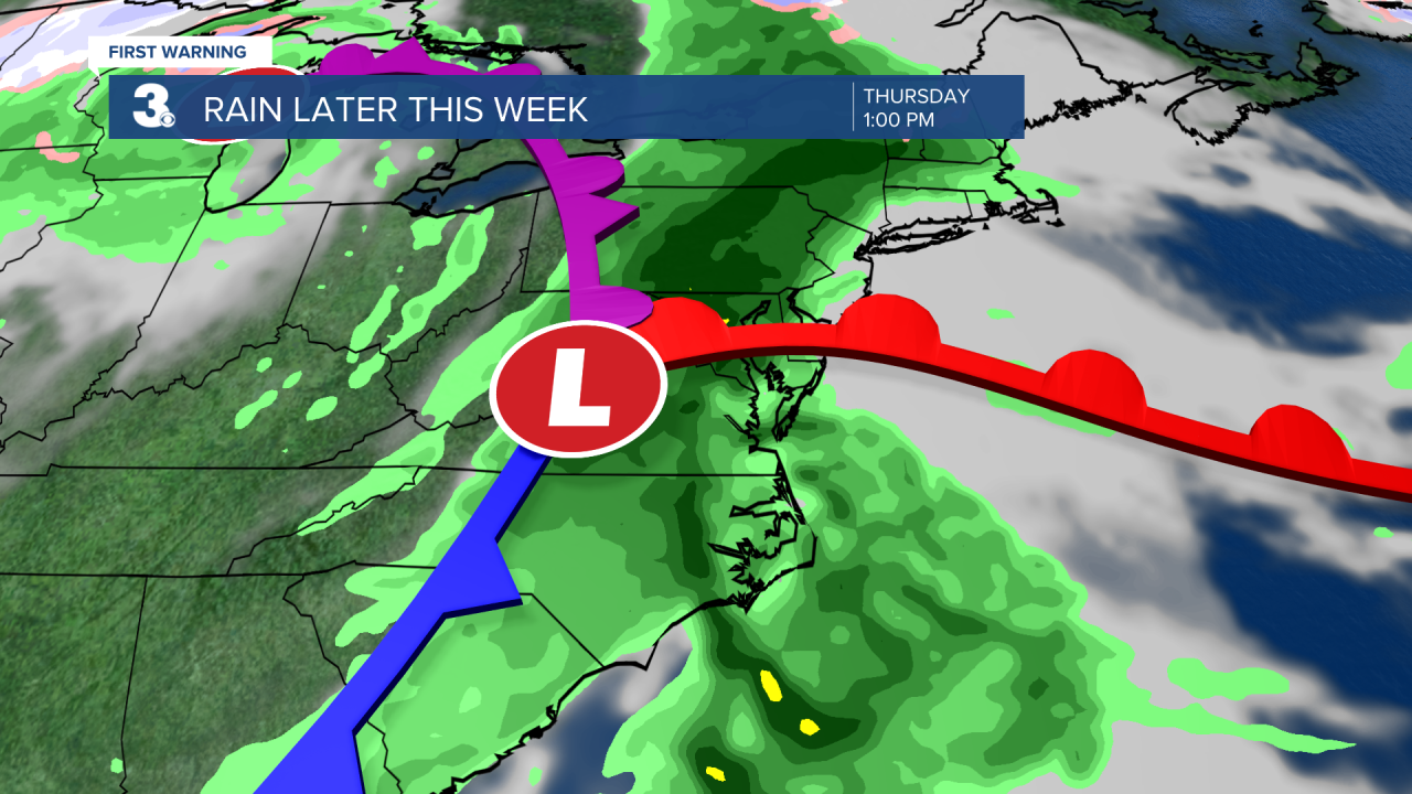
Another round of rain and storms is set to move in on Thursday with a cold front. As of now, the biggest chance will be Thursday afternoon to evening. Strong to severe thunderstorms are possible.
Highs will drop to the 60s for Friday and the weekend. Expect partly cloudy skies with a few lingering showers possible (20% chance) Friday and Saturday. More sunshine will mix in for Sunday.
Today: AM Sun, PM Clouds. Highs in the low 60s. Winds: N/W/S 5-15
Tonight: Partly Cloudy. Lows in the upper 40s. Winds: S 5-10
Tomorrow: Partly Cloudy, Warmer. Highs in the mid 70s. Winds: S 10-15
Weather & Health
Pollen: High (Maple, Juniper, Birch)
UV Index: 7 (High)
Air Quality: Good (Code Green)
Mosquitoes: Low
Weather updates on social media:
Facebook: MylesHendersonWTKR
Twitter: @MHendersonWTKR
Instagram: @MylesHendersonWTKR
